Subject: Western Hemisphere - America
Period: 1705 (circa)
Publication: Atlas Historique
Color: Hand Color
Size:
17.3 x 13 inches
43.9 x 33 cm
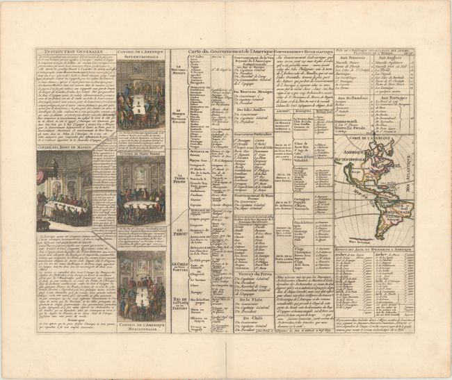
A folio sheet filled with fascinating French text, statistics and four engravings showing the Council of the Indies dividing up Spanish Empire in America. The map itself (3.7 x 5.2") shows an unnamed island of California on the Sanson model. The only political detail is the division of the regions between the colonial powers. Far to the south, a purely speculative Antarctic continent is suggested as Terre Inconnue.
References: McLaughlin #164.
Condition: A
A dark impression on paper with a Strasbourg Lily watermark, light printer's ink residue, and a faint stain in the tables to the left of the map. There is an archivally repaired centerfold separation confined to the bottom blank margin.