Subject: Northwestern Africa
Period: 1705 (published)
Publication: Algemeene Weereld-Beschryving…
Color: Hand Color
Size:
11 x 6.8 inches
27.9 x 17.3 cm
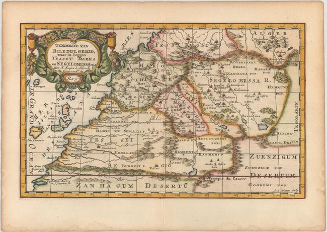
This striking map of southern Morocco and the Canary Islands is fully engraved with cities, mountains, rivers, oases, and trails. The top left corner is decorated with an elaborate title cartouche. Engraved by Antoine d'Winter. Published in Francois Halma's Dutch edition of A. Pherotee de la Croix's Nouvelle Methode Pour Apprendre facilement la Geographie Universelle.
Sanson's small maps from his L'Afrique en Plusieurs Cartes..., first published in 1656 and engraved by A. Peyrounin, were copied several times by various map publishers. Johann David Zunners made copies of Sanson's maps for his German translation of Die Gantze Erd-Kugel in 1679. Johannes Ribbius and Simon de Vries published copies in 1682 and 1683, with new maps engraved by Antoine d'Winter. The plates were later sold to Francois Halma, who used them in 1699 and then again in 1705 with the titles re-engraved in Dutch. The titles on the d'Winter plates were re-engraved back into French, and then used by Nicholas Chemereau in 1715 and by Henri du Sauzet in 1738.
References:
Condition: A
A sharp impression with light toning and minor damp stains all confined to the edges of the sheet.