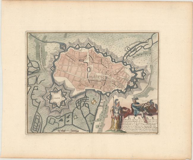
Subject: Lille, France
Period: 1710 (circa)
Publication: Les Forces de l'Europe…
Color: Hand Color
Size:
10.2 x 7.9 inches
25.9 x 20.1 cm
Nicolas de Fer held the title of geographer at Louis XIV's court. He was one of the most prolific publishers of plans of European cities in the late seventeenth century. The fortifications plans in Les Forces de l'Europe were designed to teach fortification techniques. Engraved by Van Loon and Schoonebeek after French engineers under the command of Vauban, the renowned military architect. The illustrations often include a description and a legend with the principal buildings; each city plan includes both fortifications and street layout.
This plan illustrates the large fortifications and citadel of Lille. The title cartouche features Mercury and two soldiers. Engraved by Herman van Loon and published by Nicolas de Fer, Geographer at Louis XIV's court. He was one of the most prolific publishers of plans of European cities in the late seventeenth century.
References:
Condition: A
A nice impression with a large coat of arms watermark and light toning along the edges of the sheet.