Subject: Netherlands, Low Countries
Period: 1635 (published)
Publication: Historia Mundi or Mercators Atlas...
Color: Hand Color
Size:
7.6 x 5.1 inches
19.3 x 13 cm
This lot includes four regional maps of the Netherlands that appeared in the English edition of Mercator's Atlas Minor, which was published under the title Historia Mundi or Mercators Atlas by Michael Spark and Samuel Cartwright. After acquiring the plates to the 1607 edition of the Mercator/Hondius Atlas Minor, Sparke republished the maps with text translated into English by Wye Saltonstall. Sparke also had 41 additional maps engraved for the Historia Mundi. Most of these maps were copied from Cloppenburg's edition of Atlas Minor and are therefore a bit larger, and some were signed by the engravers Jacob van Langren and Ralph Hall. These additional maps only appeared in the 1635, 1637 and 1639 editions of the Historia Mundi and are therefore quite scarce. This lot includes three of the original maps of the Netherlands that appeared in the earlier editions of the Mercator/Hondius Atlas Minor as well as one of the newly engraved maps (Zutphania Comitatus) commissioned by Sparke. English text on verso. Sizes vary slightly. This lot includes:
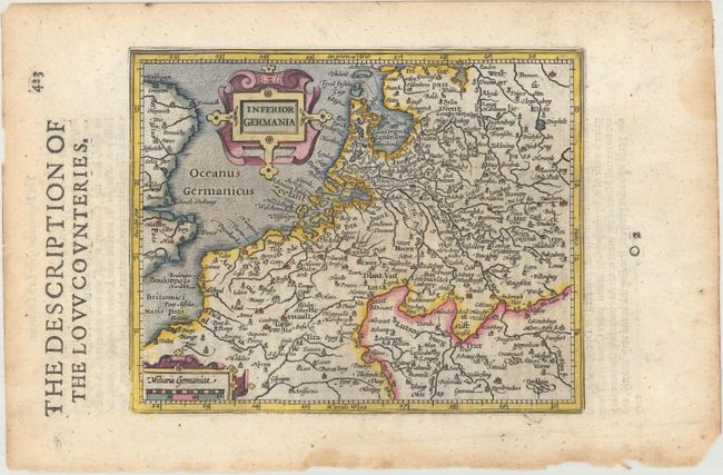
A. Inferior Germania. This map of the Low Countries includes extends to include parts of western Germany and northern France. It extends south to Compiegne, France and Saarbrucken, Germany, and as far east as Bremen and Frankfurt in Germany.
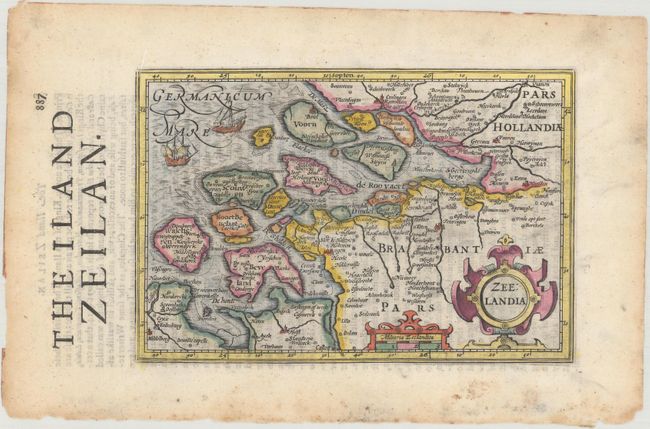
B. Zeelandia. This shows southwestern Netherlands, extending north to Rotterdam, east to 's Hertogenbosch, and south to Hulst. This map was printed on the wrong sheet in this edition; it was printed in place of a map of Sri Lanka (Ceilan Insula), and therefore has text on verso regarding Sri Lanka.
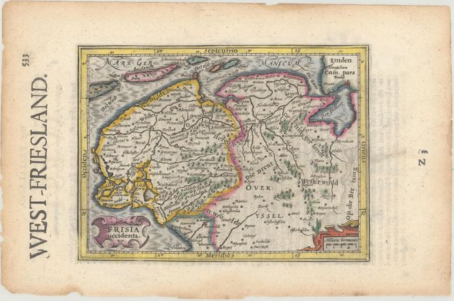
C. Frisia Occidenta. This shows the northern portion of the country, extending as far south as Meppel.
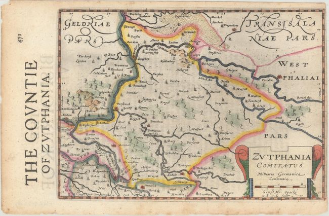
D. Zutphania Comitatus. This shows part of present-day Gelderland, extending west to Arnhem, north to Deventer, and east to Vreden, Germany.
References: Van der Krogt (Vol. III) #3000:351; 3600:351; 3713:351 (Sparke); 3900:351.
Condition: A
Crisp impressions with light toning along the edges of the sheets and a few small chips and tears also along the edges. The map of Zutphania has a narrow margin at right, as issued.