Subject: Europe
Period: 1680 (circa)
Publication: The English Atlas
Color: Hand Color
Size:
21.3 x 17.1 inches
54.1 x 43.4 cm
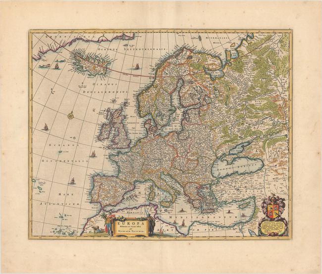
This handsome map of Europe extends from Iceland and the western coast of Greenland to the northern coast of Africa. Finely engraved details include cities and topography. The title cartouche is flanked by figures representing the bounties of Europe. A splendid cartouche to the right dedicates the map to Simon van Hoorn, a burgomeister of Amsterdam. The map appeared in Moses Pitt's The English Atlas.
References: Shirley (BL Atlases) T.PITT-1a #4.
Condition: A
On watermarked paper with light printer's ink residue, a few tiny worm holes, and some minor spots of foxing mostly confined to the blank margins. There are professionally repaired centerfold separations in the top and bottom blank margins.