Subject: Bermuda
Period: 1638 (published)
Publication: Atlas Novus
Color: Hand Color
Size:
20.3 x 15.5 inches
51.6 x 39.4 cm
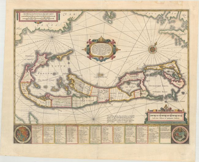
A striking map based on the famous survey by Richard Norwood of the Bermuda Company, also known as the Somers Isles Company, in 1618. The map shows the division into the original Tribes, a short-lived term for the major shareholders in the company, that became administrative parishes. Also shown are the various landowners, with their names in a table below the map. There are many tiny houses shown on the map, locating settlements, as well as minute cannons marking the defensible points. The map is superimposed over a chart of the Atlantic with the coastlines of Britain, North America, and Hispaniola showing the location of Bermuda. Decorated with an exquisite strapwork cartouche, a coat of arms, a medallion and a compass rose. Latin text on verso.
References: Palmer (MCC-19) #8; Van der Krogt (Vol. I) #9660:1.1.
Condition: B+
A nice impression on watermarked paper that has been backed with tissue. There is light text show-through and professional repairs to several tears surrounding the coat of arms at left and the third panel of text also at left. There is a small amount of image loss from the coat of arms.