Catalog Archive
Auction 168, Lot 39

"Carte des Deux Regions Polaires Jusqu'au 45e. Degre de Latitude", Buffon, Comte de
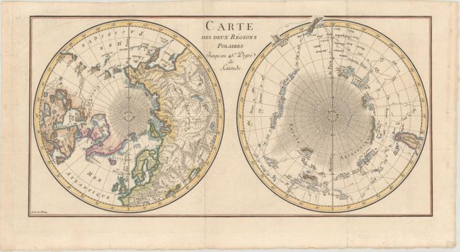
Subject: Polar

Period: 1778 (circa)

Publication: Histoire Naturelle Generale et Particuliere

Color: Hand Color

Size:
17.5 x 8.7 inches
44.5 x 22.1 cm
Download High Resolution Image
(or just click on image to launch the Zoom viewer)

Interesting map of the poles that shows numerous tracks of explorers, including Tasman, Furneaux, Halley, Marion, and the 1773 expedition of Cook. There is an unusual and utterly spurious Northwest Passage shown from Hudson Bay via Wager Inlet into la Gde. Eau des Sauvages, farther down into L. de Fonte and thus to the Pacific. There are many ice floes or icebergs depicted in both poles. Engraved by Aldring.

References:

Condition: A

A nice impression, issued folding on watermarked paper with a hint of offsetting and light marginal soiling.

Estimate: $200 - $230

Sold for: $100

Closed on 6/6/2018

Archived