Subject: Venezuela
Period: 1640 (circa)
Publication: Theatrum Orbis Terrarum
Color: Hand Color
Size:
18.9 x 14.8 inches
48 x 37.6 cm
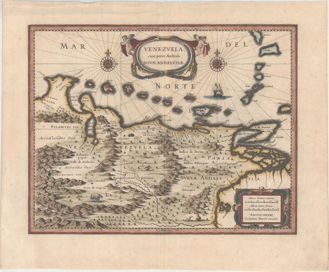
This beautifully engraved map based on the cartography of Hessel Gerritsz covers the northern coast of South America, Venezuela, east to the mouth of the Orinoco, and includes the offshore islands from Aruba through Dominica and Tobago. The fine engraving illustrates the mountains, forests, rivers, and indigenous animals but shows place names primarily along the coastlines owing to the relatively few explorations made into the interior. The map is richly embellished with title and distance scale cartouches, compass roses, and a galleon. Using the plate bought from Jodocus Hondius' widow in 1629, Blaeu changed the imprint and issued this map along with several other American maps from about 1630 to 1672, when fire destroyed the printing house. Latin text on verso, published between 1640-55.
References: Van der Krogt (Vol. II) #9830:2.2.
Condition: B+
A fine impression with wide, original margins, one minute worm hole in an unengraved area of map, and a few faint spots mostly confined to the blank margins. There is minor creasing along centerfold.