Catalog Archive
Auction 168, Lot 38

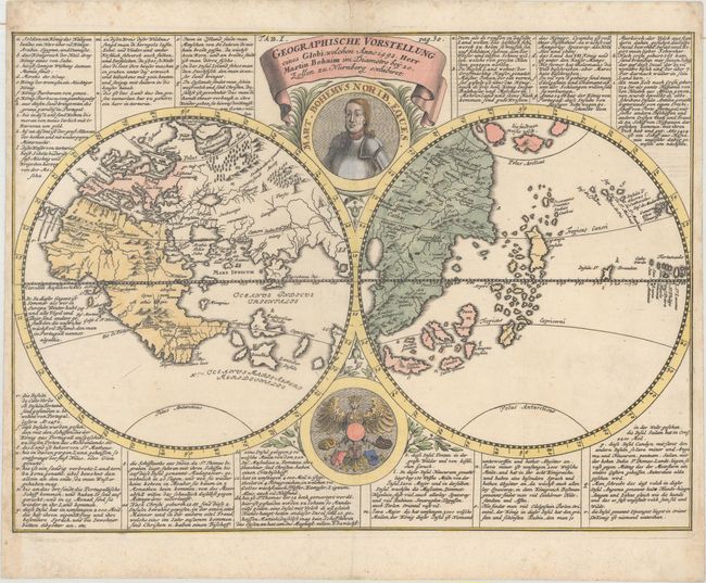
"Geographische Vorstellung eines Globi, Welchen Anno 1492. Herr Martin Behaim...", Doppelmayr, Johann Gabriel

Subject: Ancient World

Period: 1730 (circa)

Publication: Historiche Nachricht von den Nurnbergischen Mathematicis und Kunstlern

Color: Hand Color

Size:
16.1 x 11.8 inches
40.9 x 30 cm
Download High Resolution Image
(or just click on image to launch the Zoom viewer)

This map is a copy of the two hemispheres presented on Martin Behaim's 1492 Erdapfel, which is the world's oldest surviving terrestrial globe. It presents a pre-Columbian view of the world with Europe, Africa, and western Asia in one hemisphere, and Eastern Asia in the other. The map is surrounded by explanatory text and decorated by a portrait of Behaim at top.

References: Nordenskiold (Facsimile Atlas) pl. 40; Mickwitz & Miekkavaara (Vol 3) #432.

Condition: A

A nice impression on watermarked paper with a printer's crease adjacent to the centerfold and minor foxing mostly in the blank margins. There is a small paper label on verso that does not show through.

Estimate: $800 - $1,000

Sold for: $400

Closed on 6/6/2018

Archived