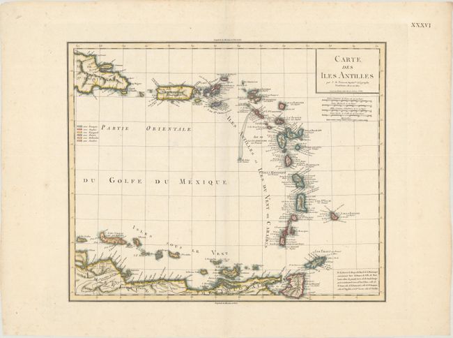
Subject: Lesser Antilles
Period: 1802 (circa)
Publication:
Color: Hand Color
Size:
16.6 x 13.6 inches
42.2 x 34.5 cm
This chart of the Lesser Antilles extends from the eastern tip of Hispaniola through the Antilles to the ABC Islands and the northern coastline of South America. It contains a dense listing of place names, more than most charts from this period. A color-coded legend at left identifies the various colonial possessions of the French, British, Spanish, Danish, Dutch, and Swedes. A note at bottom right identifies name changes for several forts and ports in the region, such as Port Royal in Martinique being renamed Fort de France. Engraved by Tardieu and likely copied from his earlier map, Carte des Antilles.
References:
Condition: A
A crisp impression on a clean, bright sheet with one tiny centerfold separation in the map that has been closed on verso with archival material.