Subject: Jamaica
Period: 1753 (dated)
Publication: Hydrographie Francoise…
Color: Hand Color
Size:
36.3 x 21.9 inches
92.2 x 55.6 cm
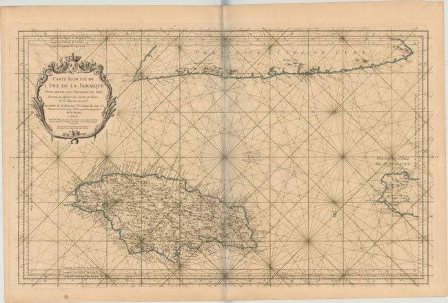
Superb, large-scale sea chart of Jamaica that is politically divided into parishes and centered on an eight-point compass rose. The map includes remarkable detail with scores of place names and safe anchorages along the coast, in addition to mountains, roads, personal estates, watershed and other details in the interior. Part of the southern coast of Cuba and the western tip of Hispaniola (Haiti) are also shown. A large decorative rococo-style cartouche further enhances the chart.
References: Kapp (MCC-42) #66.
Condition: B+
A dark impression on a sturdy sheet with a large coat of arms watermark, very minor toning and offsetting, and a few small, insignificant spots. There is a bluish shadow along the centerfold that is caused by our scanner and does not appear on the map itself.