Catalog Archive
Auction 168, Lot 351

"Carte des Isles Antilles dans l'Amerique Septentrionale, avec la Majeure Partie des Isles Lucayes Faisant Partie du Theatre de la Guerre entre les Anglais et les Americains", Brion de la Tour, Louis
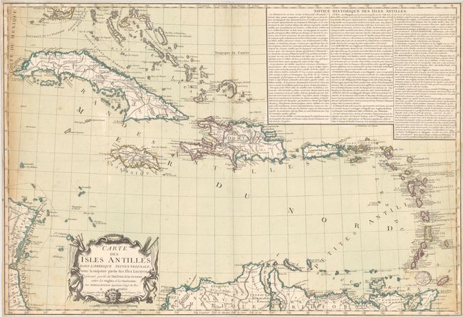
Subject: Caribbean

Period: 1782 (dated)

Publication:

Color: Hand Color

Size:
29.9 x 20.4 inches
75.9 x 51.8 cm
Download High Resolution Image
(or just click on image to launch the Zoom viewer)

This scarce map reflects aspects of the American Revolution as it affected the West Indies. The map depicts the region with fine detail including harbors and towns, anchorages, channels, shoals, banks and navigational hazards. A large block of French text describes the history and significance of the region. The title cartouche features a nautical motif.

References: Sellers & Van Ee #1741.

Condition: B

Original outline color with light, scattered foxing, an extraneous horizontal crease, and moderate soiling at far right and left. An old stamp from the "Historischen Verein für Oberpfalz und Regensburg" appears on recto at bottom right. Trimmed close to neatline on all sides.

Estimate: $800 - $1,000

Unsold

Closed on 6/6/2018

Archived