Subject: Gulf of Mexico
Period: 1687 (circa)
Publication: Zee-Fakkel
Color: Hand Color
Size:
23.2 x 20.3 inches
58.9 x 51.6 cm
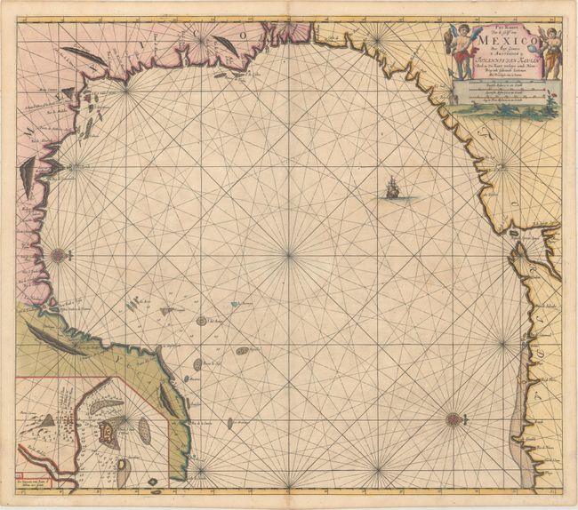
Two compass roses orient this stunning chart with north to the right. It covers the western portion of the Gulf of Mexico, stretching from the panhandle of Florida around to the Yucatan peninsula. Van Keulen's chart was mostly derived from an exceedingly rare chart by Hessel Gerritsz, c. 1631. Of note, the panhandle of Florida lacks any familiar form and the Baja de Spirito Sancto represents the mouth of the Mississippi River. An inset at lower left shows the seaport of Vera Cruz and the island Fort of San Juan d'Ulloa. The chart was engraved by the eminent geographer and mathematician Claes Janszon Vooght. It originally appeared in Johannes van Keulen's fourth volume of the Zee-Fakkel in 1684. This is the second of four states with page number "14" added at bottom left, but prior to shoals added off the coast of the Yucatan peninsula.
References: Burden #592; Martin & Martin #11.
Condition: A
A dark, sharp impression with a hint of toning and offsetting. There is a short centerfold separation in the top blank margin and remnants of hinge tape on verso.