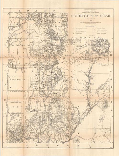
Subject: Utah
Period: 1876 (dated)
Publication:
Color: Black & White
Size:
24.7 x 31 inches
62.7 x 78.7 cm
This is a scarce, early edition of this large state survey map with terrific detail throughout. Compiled under the direction of C. Roeser, the map shows the extent of the public surveys, the Uintah Indian Reservation, Military Reservations, forests, railroads with their stations and limits, roads, trails, county seats, townships, cities and towns. The map provides particularly good information on the upper Colorado and Green Rivers.
The General Land Office produced this map as part of a series of maps of the States and Territories to celebrate the Centennial. They were recognized as the most accurate and detailed maps of their time, and subsequently were widely used by commercial mapmakers.
References: Phillips (Maps) p. 948.
Condition: B
Issued folding with light toning along the fold lines and several short splits at fold intersections. Several additional small separations along the left vertical fold have been closed on verso with archival tape.