Subject: Mississippi
Period: 1825 (published)
Publication: Atlas Geographique, Statistique, Historique ... des Deux Ameriques
Color: Hand Color
Size:
8.7 x 11.3 inches
22.1 x 28.7 cm
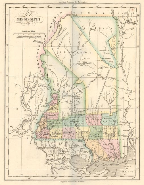
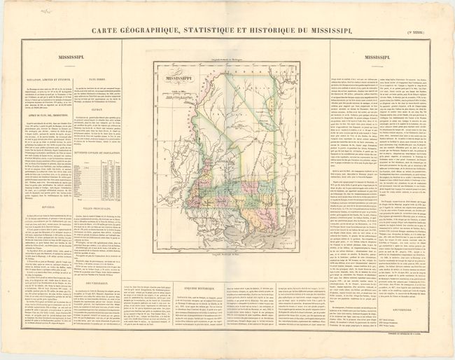
Lovely map from the French edition of Carey and Lea's American Atlas. Development is confined to the southern part of the state, with the majority of the state designated for the Choctaws and Chickasaws. Roads, forts, and a handful of cities are shown. County development is current to 1821, with the newly organized Hind county formed from the Choctaw session by Treaty of Doak's Stand. The map extends to include portions of surrounding states, including Mobile, Alabama and New Orleans, Louisiana. Identifies "General Jackson’s Road from New Orleans to the Muscle Shoals" and Baron Bastrop's Claim in neighboring Louisiana. French text surrounds the map on three sides of the large folio sheet (24.2 x 17.9"). The map was originally engraved by Young & Delleker in 1822, and published by Carey and Lea. This is their French version published by Buchon which was issued on finer paper and usually found in much better condition than his American counterparts.
References:
Condition: A+
Original color on a clean, bright sheet with deckled edges.