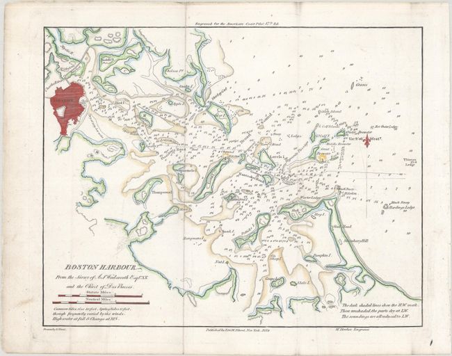
Subject: Boston, Massachusetts
Period: 1854 (dated)
Publication: American Coast Pilot 17th Edition
Color: Hand Color
Size:
10.1 x 8.1 inches
25.7 x 20.6 cm
This chart gives excellent navigational detail of Boston Harbor, with soundings, rocks, shoals, anchorages, and lighthouses noted. The chart was based on earlier surveys, including a US Navy survey from 1817 and British surveys from the Revolutionary War period. Drawn by Edmund Blunt and engraved by Hooker.
This map was published in the American Coast Pilot, a detailed guide to harbors, capes, and headlands on the east coasts of North and South America including information on winds, currents, and tides as well as latitudes and longitudes. The American Coast Pilot was published in 21 editions between 1796 and 1861, until it was replaced by federally-funded charts produced by the US Coast Survey.
References:
Condition: A
Issued folding with faint offsetting, minor extraneous creasing, and a tiny worm hole at right that is only visible when held up to light.