Subject: Florida
Period: 1850 (dated)
Publication: A New Universal Atlas...
Color: Hand Color
Size:
11.8 x 14.5 inches
30 x 36.8 cm
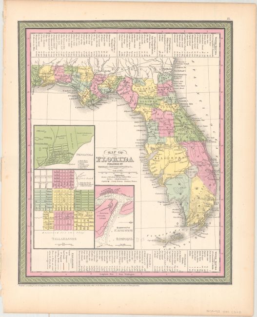
This is a very informative, early map of the state showing only 28 organized counties. Settlement in southern Florida does not extend below Forts Jupiter, Dulaney and Thompson except for Key Biscayne and nearby Fort Lauderdale and Fort Dallas. Three insets show the vicinities of Pensacola, Tallahassee and the Harbor of St. Augustine. The legend locates canals, railroads, and roads. There are two short railroads linking Tallahassee with St. Marks, and St. Josephs with Iola. County development is current to 1849 as Benton County has yet to be renamed to Hernando, which occurred in 1850.
References:
Condition: A
Original color with just a hint of toning along the sheet edges.