Subject: Northwestern United States
Period: 1860-72 (circa)
Publication:
Color: Hand Color
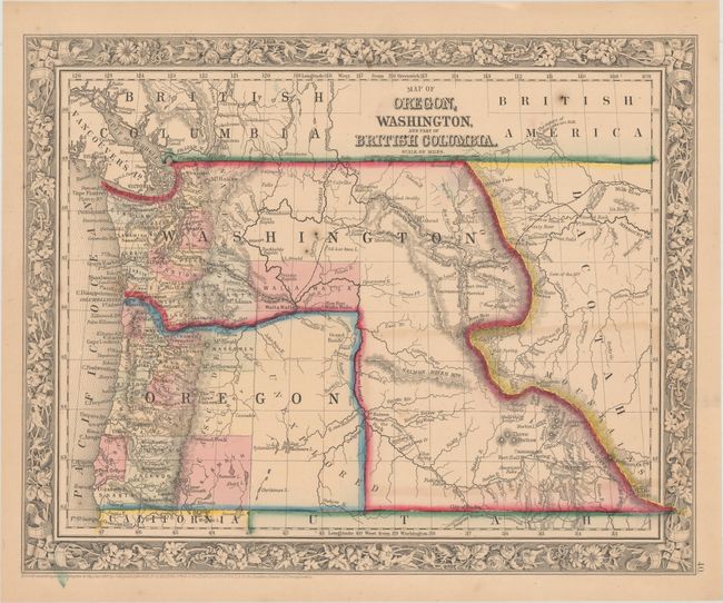
A. Map of Oregon, Washington, and Part of British Columbia, by Samuel Augustus Mitchell, dated 1860 (13.4 x 10.8"). In 1859, Oregon became a state and in the process Washington Territory gained land from Oregon that eventually became Idaho and part of Montana. The map clearly shows the Oregon Trail, and the Emigrant Wagon Road to California. The entire eastern half of Oregon is unorganized with Klamath, Curry and Wasgoren (likely an editing error for Wasco) counties being the furthest east. The eastern part of the state is labeled as unexplored. Klamath County was not organized until 1882, so its appearance here is a mystery, as the decorative floral border of this edition was replaced long before 1882. Condition: Light toning with a few minor spots and faint offsetting from an opposing map. (B+)
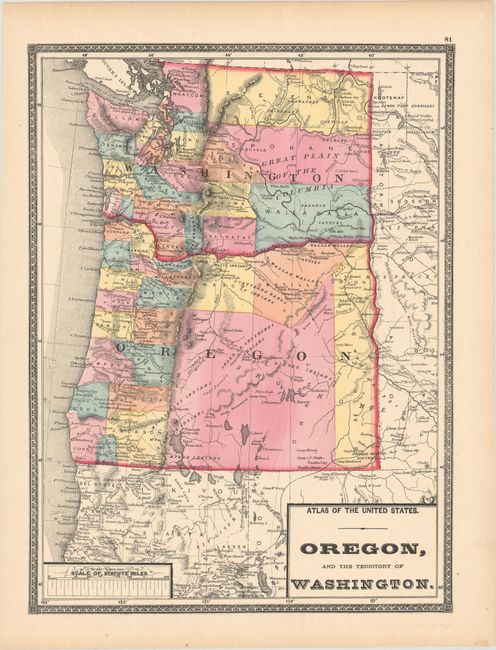
B. Oregon, and the Territory of Washington, by Stedman, Brown & Lyon, circa 1872 (11.3 x 15.1"). Issued about a decade after the first map, many new counties have organized east of the Cascades including the large Stevens, Spokane, and Walla Walla counties in the eastern half of Washington Territory. In Oregon, the eastern portion of the state is comprised of Umatilla, Union, Grant and Baker counties. In the center of the state is an unnamed area (Lake County) filled with the names of numerous Indian tribes. To its north is a note stating that the region contains "Scattered Bands of Indians." Condition: A clean, colorful example with one tiny edge tear closed on verso with archival tape. (A)
References:
Condition:
See description above.