Subject: Dakota Territory
Period: 1886 (dated)
Publication:
Color: Hand Color
Size:
16.8 x 26.3 inches
42.7 x 66.8 cm
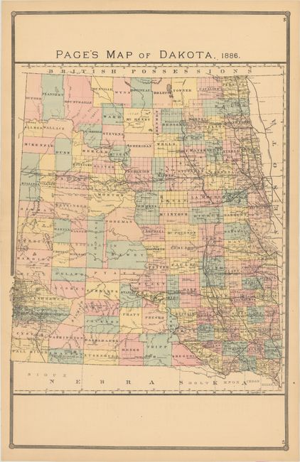
This large format map is a scarce issue of the territory by the little known H.R. Page & Co. firm of Chicago. Development is primarily concentrated in the eastern portion of the territory and along the path of the Northern Pacific Railroad. Lands of the Chippewa and Mandan Indians are noted in the northern portion of the territory. The topography around the Black Hills region is well depicted via hachure, along with good overall detail of watersheds, the state of surveying, settlements, and forts.
References:
Condition: A
Near fine with a hint of pleasant light toning.