Catalog Archive
Auction 168, Lot 189

"[Lot of 2] Map Illustrating the Plan of the Defences of the Western & North-Western Frontier, as Proposed by Charles Gratiot, in His Report of Oct. 31, 1837 [and] ... the Hon: J.R. Poinsett, Sec. of War, in His Report of Dec. 30, 1837", Hood, Washington (Lt.)

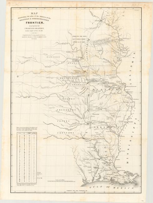
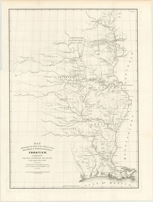
Subject: Central United States

Period: 1837 (dated)

Publication: Sen. Doc. 65, 25th Congress, 2nd Session

Color: Black & White

Size:
15.1 x 21.4 inches
38.4 x 54.4 cm
Download High Resolution Image
(or just click on image to launch the Zoom viewer)

These two maps depict the Congressional debate over the nature of the Frontier Defenses between the Mississippi River and the Rocky Mountains, illustrating the proposals of J.R. Poinsett and Charles Gratiot. Both maps depict the states of Missouri, Arkansas, Louisiana, and Indian nations bordering them to the west. Military forts and outposts from Ft. Jessup to Ft. Snelling are designated, and notations identify the lands ceded by several Indian nations with dates of the treaties. The threat posed by hostile Indians, whose numbers greatly exceeded those of the settlers in the area, resulted in a protracted Congressional debate concerning the defenses required along the frontier. Poinsett's plan is the least detailed. Gratiot’s plan adds a table showing distances between forts and "days of march" at 15 miles per day.

References: Wheat (TMW) #426 & #427; Clausen & Friis #182 & #183.

Condition:

The Poinsett map is clean, bright and fine (A+). The Gratiot map has light scattered foxing mostly along the fold lines (B+). Both maps were issued folding.

Estimate: $350 - $425

Sold for: $150

Closed on 6/6/2018

Archived