Subject: Colonial Central United States, Louisiana Territory
Period: 1720 (circa)
Publication:
Color: Black & White
Size:
16.1 x 14 inches
40.9 x 35.6 cm
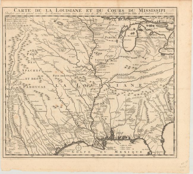
This is a reduced-size edition of Delisle's influential map of the French possession of Louisiana that drew together the cartographic work of the previous half century and had a tremendous impact on the history of cartography. When originally published in 1718, it was the first detailed map of the Gulf region and the Mississippi, and the first to show the explorations of De Soto, Cavelier, Tonty, Moscoso, and Denis. The map was designed for the political purpose of invalidating the English claims west of the Appalachian Mountains and laid claim to Carolina by the French, which provoked an angry English response. The name Texas made its first appearance in print on the earlier edition of this map, with the legendary Mission de los Teijas, established in 1716. The notation of Indiens errans et anthrophages along the Gulf Coast warns of cannibals. However, it is the cartography of the Mississippi Valley for which the map is notable today. Due to the reduced scale, this edition omits the inset depicting the mouth of the Mississippi.
References: Cumming (SE) #175; Tooley (Amer) p.22, #44; cf. Wheat (TMW) #99; cf. Martin & Martin #19.
Condition: B+
A dark impression, issued folding, with some small spots.