Subject: Eastern United States
Period: 1853 (dated)
Publication:
Color: Black & White
Size:
132.7 x 30.7 inches
337.1 x 78 cm
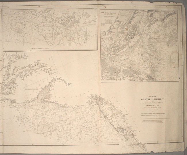
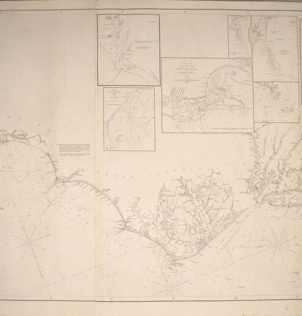
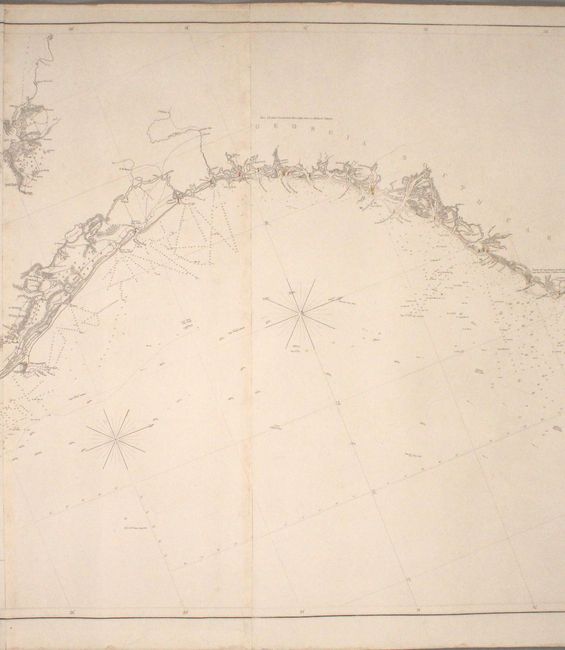
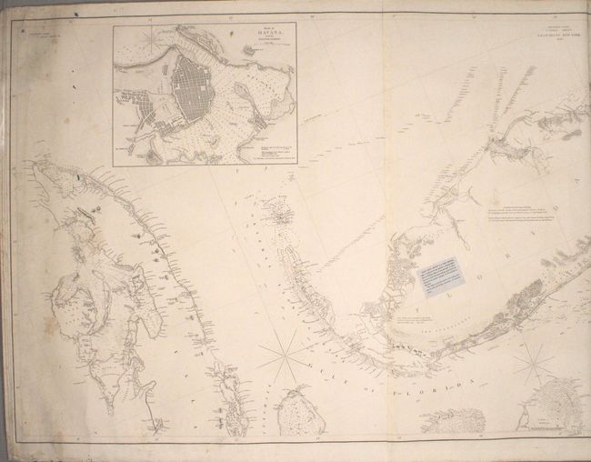
This remarkable, large-scale, blue-backed chart covers almost the entire eastern coast of the United States from western Cuba to Rhode Island, with north oriented to the right. Includes incredible coastal detail of the Florida Keys, the Outer Banks of North Carolina, the Chesapeake & Delaware Bays, and Long Island. The chart extends upstream of several of the larger rivers to include the cities of Richmond, Washington, Baltimore, and Philadelphia. Nine insets provide additional detail for important ports including New York Harbor and Havana. Packed with information useful to the mariner, the chart includes numerous depth soundings, shoals, anchorages, current directions, and ground types. Numerous lighthouses are identified with red and yellow hand color. Drawn and engraved by Charles Copley. Backed with stiff blue paper.
References:
Condition: B+
The chart is in remarkable condition for its size. There are minor dampstains along the far right and left border, a few small abrasions at left and right with only minor paper loss (no image loss), and a few edge chips confined to the blank margins at right.