Subject: Eastern United States
Period: 1819 (circa)
Publication: Storia della Guerra dell' Independenza degli Stati Uniti d'America
Color: Black & White
Size:
19 x 12.4 inches
48.3 x 31.5 cm
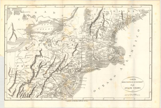
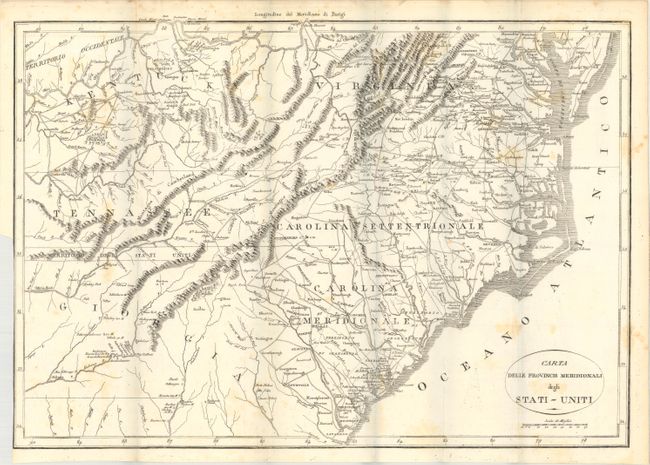
These two maps of the young United States are from an 1819 Italian edition of Botta's Storia della Guerra dell' Independenza degli Stati Uniti d'America, which is based upon Francois la Rochefouchauld Liancourt's Travels through the United States of North America…, first published in 1799.
The northern map extends from the Passamaquoddy Bay in Maine down to Delaware and west to Lake Erie. The southern sheet is from the Chesapeake Bay to Savannah, Georgia and west to Tennessee, covering Kentucky, Virginia, Tennessee, North and South Carolina and part of Georgia. These maps provide a nice view of early settlements and roads, as well as the mountains and forests. Between Tennessee and Georgia is a long strip of land labeled Territorio degli Stati Uniti. This land originally belonged to South Carolina but was ceded back to the United States in 1787, subject to Indian occupancy. Numerous Indian villages are shown, especially in the region of present-day Alabama.
References: Howes #B-636; cf. Howes #L-106.
Condition: B+
Issued folding with light scattered foxing and minor staining. Binding trims at lower left are trimmed to the neatline.