Subject: Colonial Eastern United States & Canada
Period: 1720 (circa)
Publication: Atlas Historique...
Color: Hand Color
Size:
19.4 x 16.6 inches
49.3 x 42.2 cm
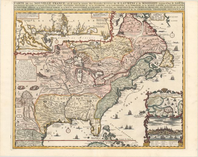
Derived from Nicholas de Fer's important four-sheet map of 1718, this is the most informative map of the French possessions in North America in the early 18th century. Louisiana and the Mississippi Valley are based on Delisle's manuscript map of 1701, while the geography of New England and eastern Canada originates with Franquelin. Inset at top left is a large-scale map of the Mississippi Delta and Mobile Bay, based on the voyage of Pierre Le Moyne d'Iberville. Another inset plan and view of Quebec is enclosed in a very decorative cartouche at bottom right. The map is filled with wildlife, scenes of Indians hunting, Indian villages and notations, and the oceans are embellished with numerous ships, canoes and sea monsters. It was issued to promote the recently established Compagnie Francoise Occident, which was formed to fund the debt of Louis XIV and offered inducements to encourage settlement in Louisiana.
References: Verner and Stuart-Stubbs #11; Kershaw #332; McCorkle #719.4.
Condition: A
A superb, crisp impression on a clean, bright sheet with a minute centerfold separation near the center that has been archivally repaired. The top margin is a bit narrow, as issued, but ample for framing.