Catalog Archive
Auction 168, Lot 122

"Carte du Cours du Fleuve de Saint Laurent Depuis la Mer Jusqu'a Quebec, en Deux Feuilles ... IIe. Feuille", Bellin, Jacques Nicolas

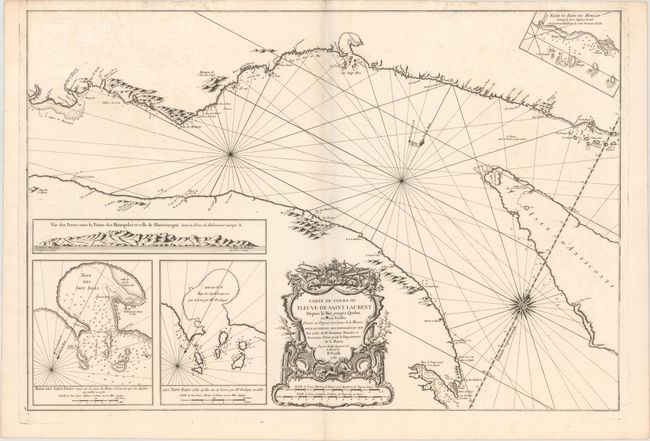
Subject: St. Lawrence River, Canada

Period: 1761 (dated)

Publication: Hydrographie Francoise

Color: Black & White

Size:
33.2 x 22.4 inches
84.3 x 56.9 cm
Download High Resolution Image
(or just click on image to launch the Zoom viewer)

This is the first state of this large-scale sea chart that covers part of the St. Lawrence River from Anticosti Island to Outards River. It includes insets of the Sept Isles in the Cote-Nord region of eastern Quebec, Isles of Mingan, and a coastal view of Manicouagan. The detailed map has rhumb lines emanating from a fantastic compass rose and a baroque-style title cartouche.

References: Kershaw #655.

Condition: A

A sharp impression on a watermarked sheet with a small ink spot in the title cartouche, and a couple short edge tears just entering the neatline at top that have been closed on verso with archival materials.

Estimate: $400 - $500

Unsold

Closed on 6/6/2018

Archived