Subject: Colonial North America
Period: 1775 (dated)
Publication: Atlas Universel
Color: Hand Color
Size:
23.2 x 19 inches
58.9 x 48.3 cm
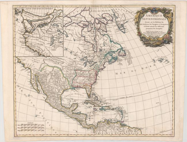
The colonial possessions are well defined on this influential map of North America that was published immediately prior to the outbreak of the Revolutionary War. The region west of the Appalachians is referred to as Chouanous et Cheraquis referring to the Shawnee and Cherokee Indian. There are numerous other Indian names throughout the Mississippi River valley and New Mexico. The Southwest is largely blank and a large inset of the northwest region fills the rest of the map. This inset is filled with mythical cartography reflecting the desire for a Northwest Passage including Belle Riviere, , L. de Fonte, L. Velassco, and Lac Bernarda. This desirable and less common version is the fourth of five states; the first to include the inset.
References: Pedley #448.
Condition: B+
A crisp impression on watermarked paper with faint damp stains in corners and some light, small mildew stains at bottom.