Subject: History Books
Period: 1850 (circa)
Publication:
Color: Hand Color
Size:
7.8 x 11.4 inches
19.8 x 29 cm
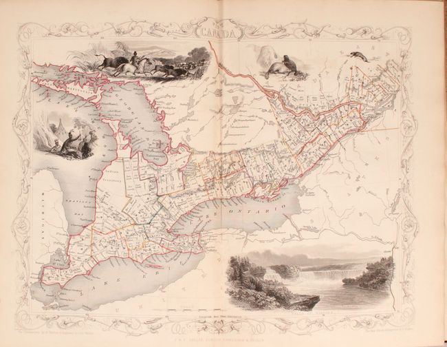
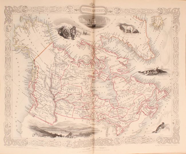
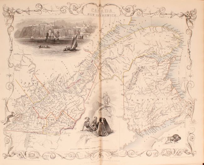
The maps from The Illustrated Atlas were first published in serial form to a target audience that led insular lives due to the expense and hardship of travel. All that changed as the progress of the nineteenth century brought swift and dramatic changes in public awareness of far away places. Tallis' maps no doubt played an important role in this dramatic awakening. These maps not only provided up-to-date geographical knowledge, but also used vignette views within the map's design to show the native people and their occupations, cities and points of interest. The maps hark back to a cartographic tradition from the Dutch mapmakers of the seventeenth century with finely engraved decorative borders. The maps were drawn and engraved by John Rapkin with views drawn and engraved by a number of prominent artists. The maps were issued as a complete volume from 1851 until about 1865. Some of the maps were also published in other history books published by Tallis including British Colonies and, without the vignettes, in geographical dictionaries and encyclopedias until about 1880.
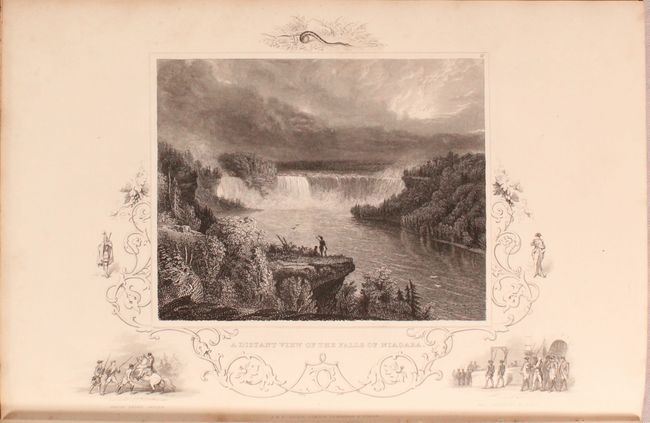
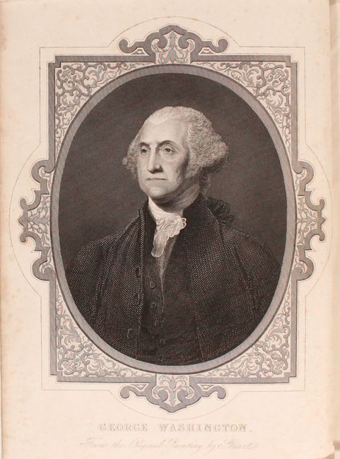
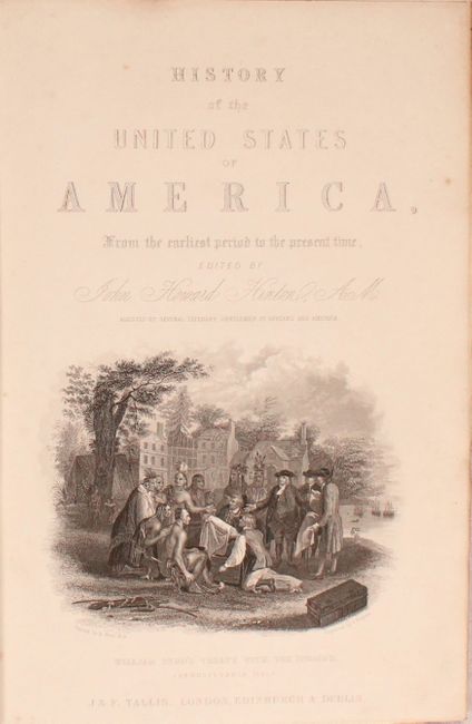
This six volume work was edited by John Howard Hinton and published by John Tallis. The text is divided into two parts: History of the United States... and Topography of the United States and total 1,648 pages. The volumes are profusely illustrated with lovely steel-engraved plates including portraits of George Washington, Noah Webster and views featuring Natural Bridge, the Erie Canal, Niagara Falls, and the U.S. Capitol building to name a few. Tallis has inserted seven important maps of the region (including several uncommon issues) to complete the volumes including:
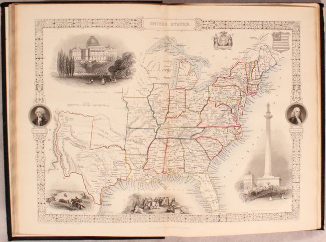
United States. An uncommon version of this map of the eastern states with the new state of Texas shown. Its panhandle extends to the Arkansas River and including Santa Fe and Taos. Wisconsin and Iowa are shown with amorphous boundaries and the Indian Territory is not named. Precisely engraved to show a surprising amount of detail for a map of this size. Surrounded by a decorative border that incorporates portraits of Washington and Franklin in circular elements. Also with vignettes showing the Capitol, a buffalo hunt, Penn's treaty with the Indians, and Washington's Monument which includes a statue at the top that was planned, but never installed. Further embellished by the Excelsior seals and the U.S. shield.
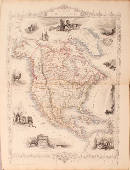
North America. This is an uncommon issue of this decorative steel engraved map that features Texas shown with an enlarged panhandle that extends into New Mexico and Colorado. The boundary between Canada and the United States reflects British claims in the Oregon Territory with a line fixing the boundary south of the Columbia River. Mexico is still in control of California and the Southwest. The map is filled with forts and locates many Indian tribes. Alaska is Russian America. Several lovely vignettes appear around the continent, including Wapiti Deer, Beavers, North American Indians, Ancient Monument, Mexico, and Convoy of Diamonds. Across the top are images of Russian Cossacks (representing the Russian Possessions in Alaska), an Eskimo dog sled, and Mount Hekla, Iceland.
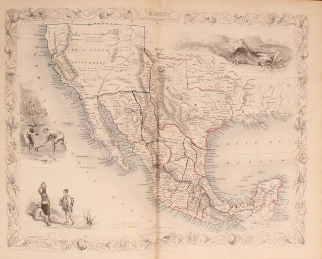
Mexico, California and Texas. This is the second, and most desirable, state of this fine steel-engraved map that was issued during a time of great transition in the region. After gold was discovered in California, the plate was re-engraved to include a vignette of gold panning and to locate the gold regions of California which are delineated through hand coloring. Texas is shown with its original state borders that include much of present-day New Mexico and extend into Colorado. Two other vignettes show Mexican peasantry and the ancient Mayan ruins at Uxmal. The very decorative border incorporates native plants of the region.
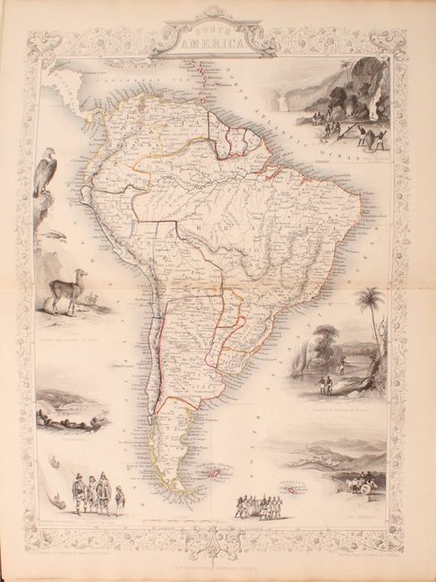
South America
West Canada
British America
East Canada and New Brunswick
6 volumes, 7 maps, 58 plates and 1,648 of text divided into two parts. Hardbound in blue blindstamped cloth with gilt decorations on covers and spines.
References:
Condition: B+
The maps are overall very good to near fine with occasional light toning and faint foxing. The plates are very good with scattered foxing. Text is clean, bright, and near fine. A former owner's bookplate is present on the front pastedown of each volume. Covers have only light wear with bumped edges. The fore-edge of the front board of volume 1 has a narrow paint stain.