Subject: Geography Books
Period: 1850-68 (published)
Publication:
Color: Hand Color
Size:
10.3 x 12.5 inches
26.2 x 31.8 cm
This pair of geography books by Mitchell is notable for its unusual maps of Texas and for its provenance: these volumes were part of the personal collection of the late map scholar Rodney Shirley.
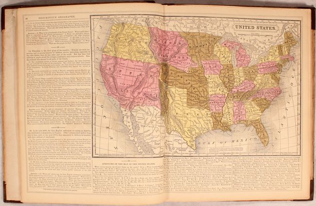
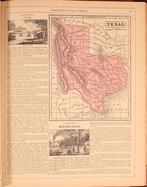
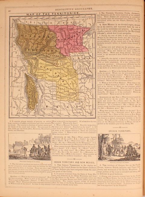
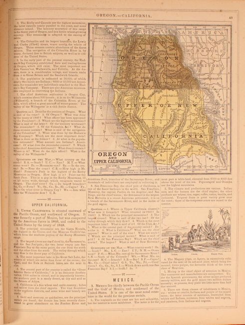
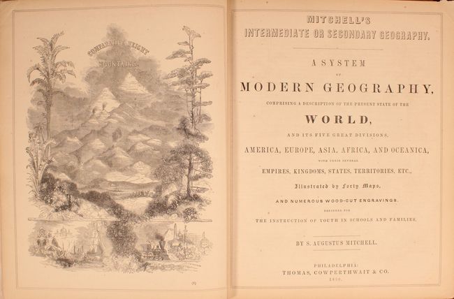
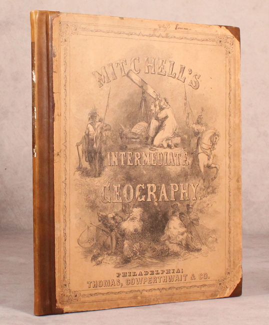
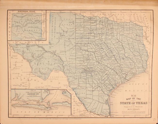
A. A System of Modern Geography, Comprising a Description of the Present State of the World..., published 1850, (10.3 x 12.5"). This complete example of Mitchell's Geography was published for "the instruction of Youth in Schools and Families." It is richly illustrated with wood engraved vignettes, diagrams and statistics. It includes maps of America, Europe, Asia, Africa, Oceanica, and all of the states and territories of the United States. This fine geography contains 40 hand-colored maps, several U.S. maps with unusual western boundaries, an elaborate frontispiece describing the Comparative Height of Mountains, and six pages of amusing advertisements. The map of Texas shows the state in its largest configuration, circa 1846. The map of the west contains only Upper or New California, which occupies all of the Southwest, and a large Oregon Territory extending west to the Continental Divide, plus more. Hardbound in 1/2 leather and pictorial boards, frontis, title page, preface, contents, engravings and maps, advertisements, 80pp. Condition: Binding is good, with new leather spine and tips to repair partially separated covers. There is an area of toning on new spine from a non-archival label that has since been removed. Text and maps generally good, with light toning, minor scattered foxing, and some dog-eared pages. First blank endpaper has several lines of manuscript in ink. (B+)
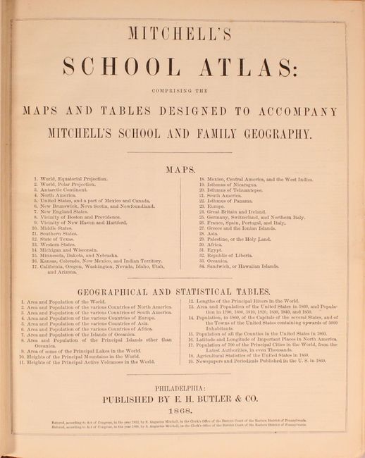
B. Mitchell's School Atlas: Comprising the Maps and Tables Designed to Accompany Mitchell's School and Family Geography, published 1868, (9.8 x 11.9"). This example of Mitchell's famous school atlas includes 22 single and double page maps along with tables and statistics. Its maps of the west are particularly notable. Map 12, Map of the State of Texas, is dated 1858 and features insets of norther Texas and the area around Galveston. The eastern section of the state is dense with counties, while the west still remains largely unsettled. 4to, pictorial covers, title page, Geograhical Tables, 22 maps. Condition: Maps are in good condition, with light toning and soiling and some tiny chips and edge tears, some of which have been backed in tissue. Front cover has been reattached using binder's tape, and there is residue from a label on the new spine. Covers in general have moderate wear, and the tips are now covered with duct tape. Previous owner's signature on first end paper. (B)
References:
Condition:
See description above.