Subject: Western Africa
Period: 1705 (published)
Publication: Algemeene Weereld-Beschryving…
Color: Hand Color
Size:
10.4 x 7.9 inches
26.4 x 20.1 cm
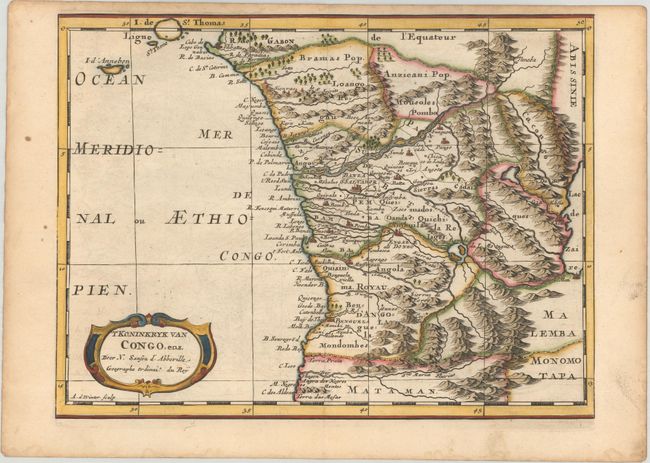
Attractive map of Gabon, the Congo and Angola from Cape Lopez and Sao Tomé to approximately the border with present-day Namibia. The map is fully engraved with mountains, rivers, forests and trails and decorated with a strapwork title cartouche. Engraved by Antoine de Winter.
This map appeared in Algemeene Weereld-Beschryving, nae de Rechte Verdeeling der Landschappen, Plaetsen, Zeeën, Rivieren, &c. Geographisch, Politisch, Historisch, Chronologisch en Genealogisch, a Dutch edition of A. Phérotée de la Croix's Nouvelle Methode Pour Apprendre Facilement la Geographie Universelle, which first appeared in 1690. The Dutch edition was published by Francois Halma and included 98 maps and views.
References:
Condition: A
A dark impression with faint offsetting, marginal soiling, and light toning along the edges of the sheet.