Subject: Mediterranean
Period: 1682 (published)
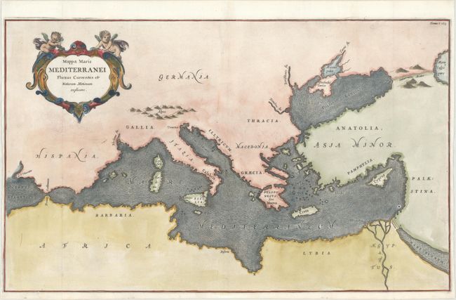
Publication: D'Onder-Aardse Weereld
Color: Hand Color
Size:
21.9 x 13.4 inches
55.6 x 34 cm
An unusual map from Kircher's masterpiece, the first serious effort to describe the physical makeup of the earth, proposing theories (sometimes fantastic) in the areas of physics, geography, geology, and chemistry. The map is devoid of political information and instead focuses entirely on ocean currents in the Mediterranean Sea. The map extends to include the Black Sea and parts of the Caspian and Red Sea. Kircher's theories included the notion that the world's oceans were all interconnected and thus this map depicts subterranean tunnels connecting the oceans and seas. The decorative title cartouche is surmounted by two putti. Published in a Dutch edition of Kircher's famous Subterranean World.
References:
Condition: A
A crisp impression issued folding, now flattened, on a bright sheet with a small "RR" watermark. There are two small holes along the neatline at top that have been professionally repaired, with a minor amount of neatline replaced in facsimile.