Catalog Archive
Auction 167, Lot 211

"Mappa Geographica, Complectens I. Indiae Occidentalis Partem Mediam Circum Isthmum Panamensem II. Ipsumque Isthmum. III. Ichnographiam Praecipuorum Locorum & Portuum ad has Terras Pertinentium...", Homann Heirs

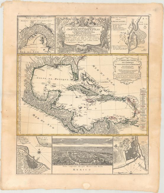
Subject: Gulf of Mexico & Caribbean

Period: 1740 (dated)

Publication:

Color: Hand Color

Size:
19.3 x 22.9 inches
49 x 58.2 cm
Download High Resolution Image
(or just click on image to launch the Zoom viewer)

This informative and very graphic folio sheet has a large map of the region, titled "Carte des Isles de l'Amerique et Deplusieurs Pays de Terre Ferme," attributed to D'Anville (1731). The map covers the Gulf of Mexico, Central America, and all of the Caribbean islands. It is nicely detailed with a key to show European possessions and a beautifully engraved title cartouche. Above the main map is the large, decorative title cartouche, flanked by insets of the isthmus of Panama and a plan of St. Augustine in Florida. Below the map is a large view of Mexico City, flanked by plans of Vera Cruz and San Domingo. A very handsome sheet, absolutely filled with information on the West Indies.

References:

Condition: B+

A nice impression with original outline color. There is light, uneven toning and a few small spots.

Estimate: $550 - $700

Unsold

Closed on 3/28/2018

Archived