Subject: Boston, Massachusetts
Period: 1897 (dated)
Publication:
Color: Printed Color
Size:
21.5 x 12 inches
54.6 x 30.5 cm
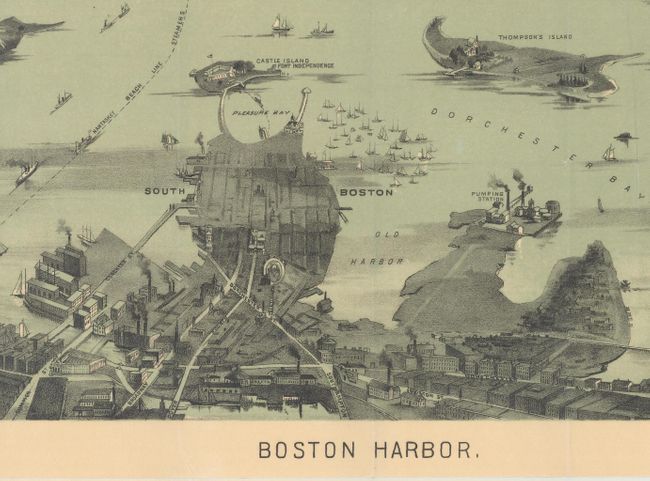
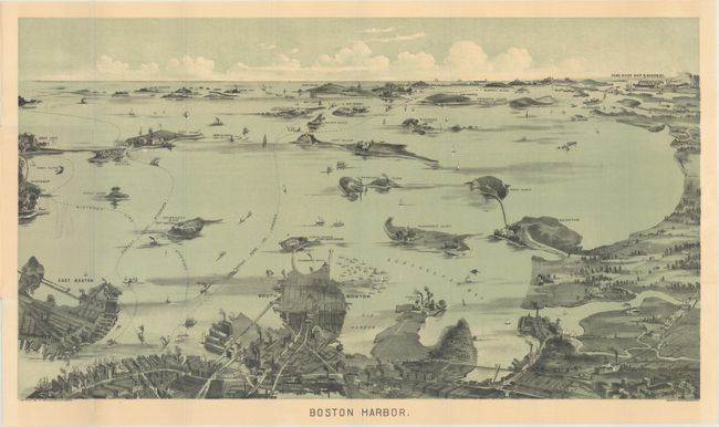
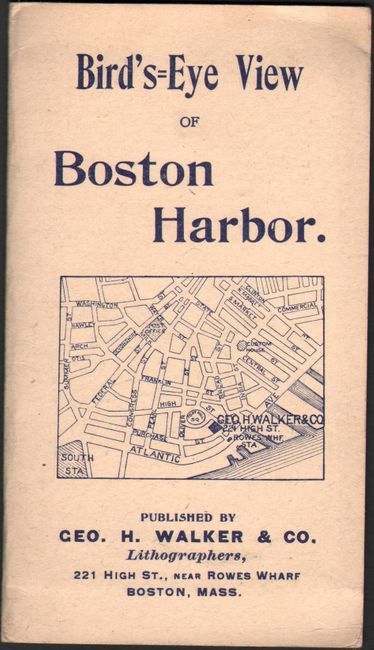
This bird's-eye pocket map of the region was produced for the tourist trade. The map extends from the coastal area of East and South Boston across the water to the main ship channel and the Boston Light. It locates Winthrop, Thompson's Island, Moon Island, Deer Island, Nahant, Green Island, the Brewster Islands, Strawberry Hill, Fort Warren, Hough's Neck and much more. The Fore River Ship & Engine Co. is on the distant horizon. Steamer routes to Nantasket Beach, Nahant, Winthrop and more are identified. On the inside cover is an extensive list of maps available from Walker Lith. & Pub. Co. with the same list on back cover along with the addition of several bird's-eye views. This map, according to the list, originally cost 10 cents. It is a fine-single color chromolithograph. It folds into paper covers titled "Bird's-Eye View Map of Boston Harbor." Walker's maps were often sold as advertising maps under another name, most notably by the Union News Co.
References:
Condition: A+
Clean, colorful, and in mint condition.