Catalog Archive
Auction 167, Lot 160

A Wonderful Set of "Scott Maps"

"[Lot of 5] A Scott-Map of Harvard University and of Radcliffe College... [and] ... Boston Massachusetts [and] ... Concord Massachusetts... [and] ... the White Mountains of New Hampshire [and] Salem Massachusetts...",

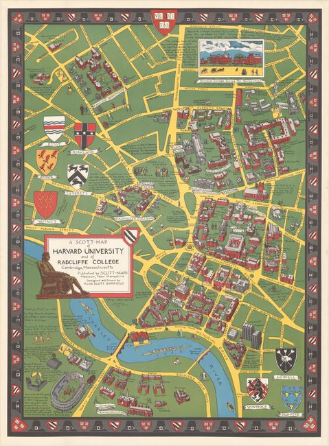
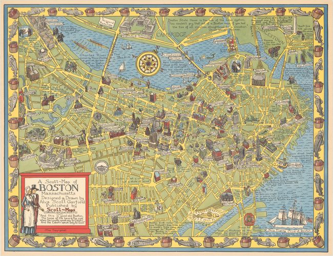
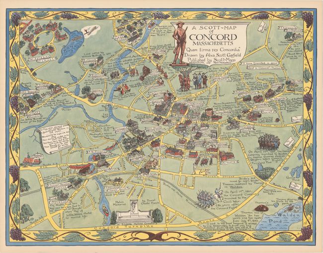
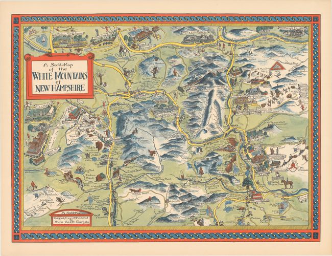
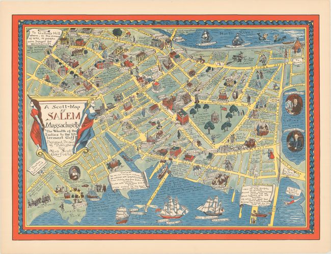
Subject: Massachusetts & New Hampshire

Period: 1949-60 (circa)

Publication:

Color: Printed Color

Size:
See Description
Download High Resolution Image
(or just click on image to launch the Zoom viewer)

This lovely set of pictorial maps was created by Alva Scott Garfield. Scott's cartographic career began in 1926 with a decorative pictorial map of her alma mater, Wellesley College, and was entitled Newe Mapp of Wellesley. In 1929, Scott produced another campus map of nearby Wheaton College (MA). Scott took a 20 year hiatus from map production to focus on other endeavors, but in the late 1940s began producing both campus maps and regional views in New England including the group below. Roderick Barron of Barron Maps wrote an outstanding article describing Alva Scott Garfield's life & work here. The full list of maps in the lot, all beginning "A Scott-Map", include:

A. A Scott-Map of Harvard University and of Radcliffe College Cambridge, Massachusetts, dated 1959 (24.0 x 32.7"). Depicts the combined campuses of Harvard and Radcliffe College with streets and individual buildings identified. The map is filled with illustrations, interesting historical facts, and the coats of arms of the various resident houses. Surrounded by a decorative border including Harvard's seal.

B. A Scott-Map of Boston Massachusetts, circa 1955 (27.0 x 20.8"). A lovely pictorial view of the Boston extending to Cambridge and Charlestown. The map is packed with illustrations, and both humorous and historical notes. Locates Boston University, the Sears Roebuck building, John Hancock building, Custom House and more. Decorated by a compass rose and border featuring cod. Beneath the title states "And this is good old Boston, The home of the beans & the cod; Where the Lowells speak only to Cabots, And the Cabots speak only to God."

C. A Scott-Map of Concord Massachusetts - "Quam Firma res Concordia", circa 1960 (27.0 x 20.7"). An attractive, whimsical map of Concord that has many references to Henry David Thoreau. Thoreau's famous cabin and Walden Pond are located at lower right, and his birthplace is shown at top right. Several other locations related to Thoreau are identified, and there are quotations from both Emerson and Thoreau on the map.

D. A Scott-Map of the White Mountains of New Hampshire, circa 1949 (27.6 x 20.3"). This highly illustrative map emphasizes the recreational and outdoor opportunities available in the region. Mt. Washington is located near the center, and several ski areas are identified. Hotels include the Mountain View House, Presidential Inn, and Sunset Hill House that has "one of the most magnificent views in the White Mountains."

E. A Scott-Map of Salem Massachusetts , circa 1950 (27.6 x 20.3"). This map pays homage to the city's maritime and colonial history, but also makes several references to the witch trials and locates an old Witch Jail and Witch House. A note at top left states "To Gallows Hill where, in the summer of 1692, 19 people were hanged for witchcraft - NO witches were burned in Salem!"

References: Hornsby (Picturing America) p. 22.

Condition: A+

A fine set on bright sheets with vivid color.

Estimate: $350 - $450

Sold for: $375

Closed on 3/28/2018

Archived