Subject: North America
Period: 1858 (dated)
Publication: Sen. Ex. Doc. No. 1. Ho. Ex. Doc. No. 2, 35th Congress, 2nd Session
Color: Black & White
Size:
18.9 x 17.4 inches
48 x 44.2 cm
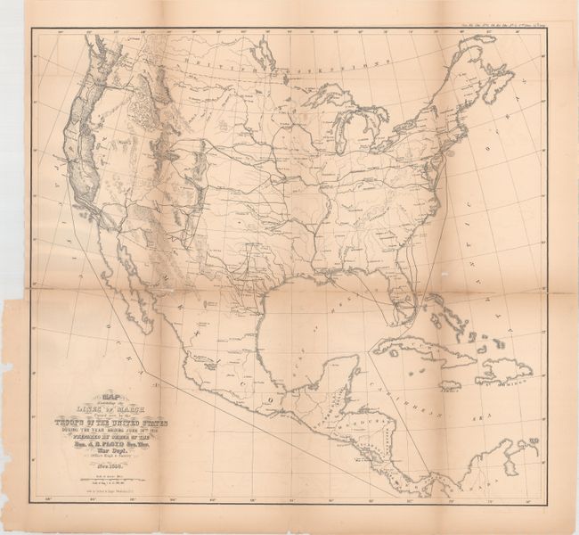
This finely engraved map shows Army troop movements throughout the United States by land and sea in the preceding year. It includes topography, hydrography, forts, towns, and international boundaries. With an average effective force of about 10,000 men, the Army was hard pressed to provide adequate security to its citizens, particularly in the frontiers of Texas, Arkansas, Arizona, and Minnesota. Thus it was necessary to constantly withdraw forces from one frontier to reinforce another. This map clearly shows the enormous logistics problem that faced the Army in its efforts to maintain a suitable force to contain the hostile Indians.
References:
Condition: B
Issued folding with light toning that is more prominent along the folds. There are numerous fold separations that have been closed on verso with archival hinge tape and one small chip in an unengraved area of the map in the Atlantic Ocean.