Subject: Colonial North America
Period: 1777 (dated)
Publication:
Color: Hand Color
Size:
45.8 x 20 inches
116.3 x 50.8 cm
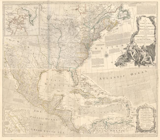
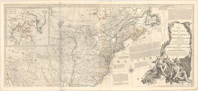
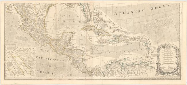
This is the sixth edition of this large, influential map that had a long and varied publishing history. Originally published to illustrate the seat of the French and Indian War, the map went through numerous revisions and editions to document the expanding cartographic knowledge and political landscape of North America. It incorporates several alterations in the Hudson Bay region and shows an early Lake Ouinipigon or Winipick. The map provides an extremely detailed view of the continent at the onset of the American Revolution. It locates hundreds of settlements and Indian villages and is filled with interesting notations referring to native tribes and historical events. A number of roads are shown on the map stretching all the way to New Mexico and New Navaar. There are two interesting inset maps. One shows the discoveries of Father Eusebius Kino in the Southwest that proved that California was not an island. The other illustrates the ongoing search for a Northwest Passage, showing Baffin and Hudson Bays with the fictional Lake de Fonte reaching nearly to Baffin Bay. The text of several articles of the Treaty of 1763 are engraved in the Atlantic Ocean. It is embellished with a bold title cartouche featuring Native Americans and indigenous animals. Printed on four sheets, joined into two horizontal pairs, as issued. Published for Robert Sayer, No. 53 Fleet Street.
References: Stevens & Tree (MCC-39) #49f.
Condition: A
Original outline color on mostly clean sheets of watermarked paper with a few minor spots, some extraneous creasing along the left fold on the upper sheet (resulting in the bluish shadow on the image, which is caused by our scanner and does not appear on the map itself), and faint toning on the lower left sheet.