Catalog Archive
Auction 166, Lot 716

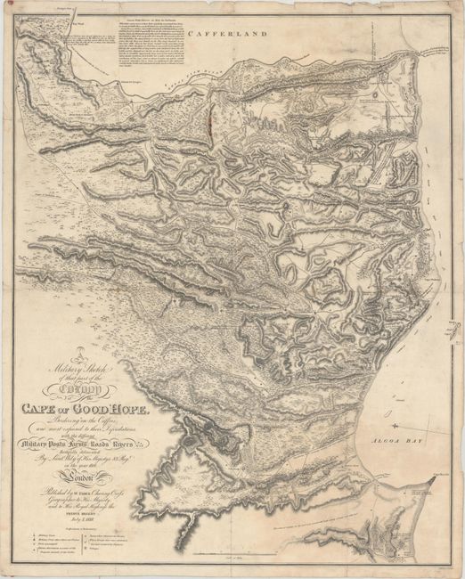
"A Military Sketch of That Part of the Colony of the Cape of Good Hope, Bordering on the Caffres and Most Exposed to Their Depredations...", Faden, William

Subject: Southern Africa

Period: 1818 (dated)

Publication:

Color: Black & White

Size:
19.3 x 23.8 inches
49 x 60.5 cm
Download High Resolution Image
(or just click on image to launch the Zoom viewer)

This map was drawn by W. Wily of the 83rd Regiment during the Kaffir Wars of the eastern colony. It covers the region from Algoa Bay/Cape Recife inland to the Great Fish River, and includes a descriptive paragraph of this river at top. The mountainous topography is well-represented via hachuring, and the legend provides a key to military posts, troop quarters, villages, and more. Decorated by fancy titling at lower left and engraved by J. Walker.

References: Norwich #232.

Condition: B+

Issued folding on watermarked paper with a few minor fold separations and light scattered foxing. There is a small line of extraneous red wax in the upper portion of the image, and remnants of wax on verso at top and bottom.

Estimate: $275 - $350

Sold for: $325

Closed on 2/14/2018

Archived