Subject: Africa
Period: 1794 (dated)
Publication:
Color: Hand Color
Size:
47.9 x 20.4 inches
121.7 x 51.8 cm
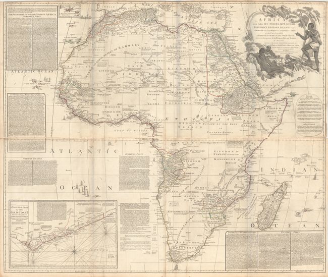
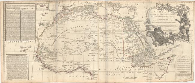
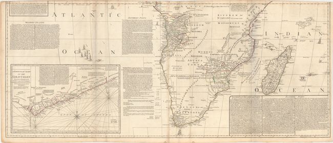
A superb, four-sheet map based on the cartography of the famous French cartographer Jean Baptiste Bourguignon d'Anville. The map provides a very detailed view along the coastline, with numerous towns and capes noted, and the topography and river system is depicted. While there is an evolving understanding of the kingdoms and tribes in the interior, the Nile River is still shown as originating from two adjacent lakes in Central Africa. There is a small inset of the Azores at top, and a sizable inset depicting the Gold Coast at bottom covering the mineral rich area from Cape Appollonia to Cape Montego. The map is surrounded with extensive descriptions of the continent and its kingdoms and tribes, and adorned by a large decorative title cartouche featuring natives gathered around a feast. This example is joined in two long, horizontal sheets, joining the two northern and the two southern sheets. If fully joined, the map would measure 47.6 x 40.6".
References:
Condition: B+
Original outline color on watermarked paper, issued folding. There is light soiling, some toning along the folds and edges of the sheet, and a few short fold separations also along the edges of the sheet. A 2" tear at top left has been archivally repaired. The grayish hue along the folds is caused by our scanner, and does not appear on the map itself. The first image is a composite image - the map is in two sections as described above.