Subject: Bacan Islands, Maluku Islands
Period: 1662 (published)
Publication: Atlas Maior
Color: Black & White
Size:
19.3 x 14.7 inches
49 x 37.3 cm
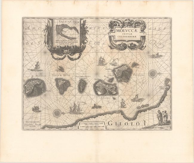
Superb map of the Spice Islands based on the islands described by Jan Huyghen van Linschoten. This map was the first large-scale map of the region and depicts the islands that provided, first the Portuguese and then the Dutch, with a monopoly on the lucrative spice trade. Each of the islands is shown with groves of the prized clove and nutmeg trees and the location of their protective fortresses. Originated by Jodocus Hondius, the plate was purchased by Blaeu in 1629. One of the very decorative cartouches encloses an inset map of Bachian Island. Rhumb lines, calligraphy, two compass roses, various types of sailing ships, and sea monsters further enrich this engaging sheet. Latin text on verso.
References: Goss (Blaeu) #196; Van der Krogt (Vol. II) #8560:2.2.
Condition: B+
A nice impression with some light staining in the image. There is a 2" tear and 1" tear adjacent to the centerfold between the two cartouches that have been closed on verso with archival tape.