Subject: Asia
Period: 1710 (circa)
Publication:
Color: Hand Color
Size:
13.9 x 9.2 inches
35.3 x 23.4 cm
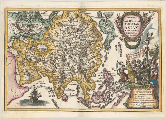
Geographically this map of Asia is very imaginative. A bulbous Terra Edso (Hokkaido) is attached to Honshu by a narrow isthmus and Compagnie Land is shown to the north of Hokkaido. Nova Zemba is shown as an island; whereas most cartographers of the period depicted only the southern and western coastlines reflecting the discoveries of Barents and Linschoten. The Caspian Sea is depicted in a curious oval shape and the whole of Central Asia is very mountainous. A partial and unnamed coastline at bottom right represents Australia. The map illustrates the various missions of the Society of Jesus with the legend distinguishing between stable and temporary missions and regions where the Catholic faith has been disseminated but repulsed. The stunning title cartouche features members of the various Asian races kneeling at the foot of the crucifixion.
References: Yeo #93.
Condition: A
A dark impression with a hint of offsetting, a printer's crease at far left, and a couple of tiny worm holes along the bottom border at center.