Subject: Holy Land
Period: 1601 (published)
Publication: Epitome Theatri Orteliani
Color: Hand Color
Size:
4.2 x 3 inches
10.7 x 7.6 cm
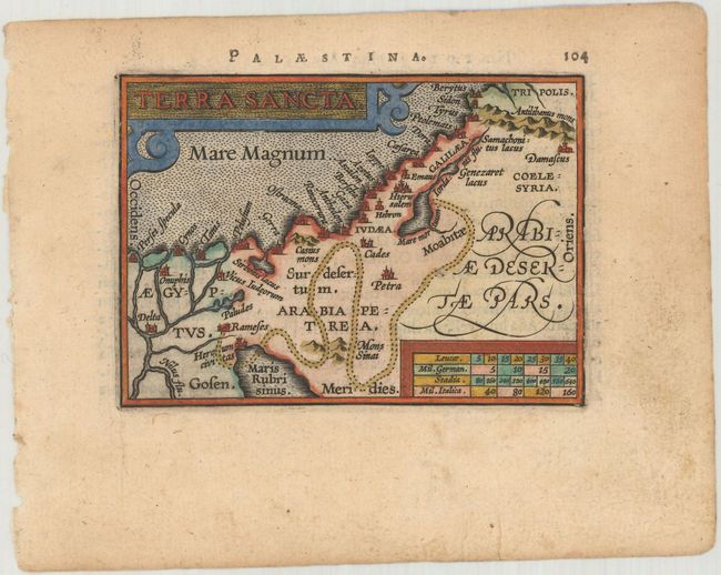
This is a miniature version of Ortelius' modern map of the Holy Land. Unlike the folio version, this map is oriented with north at top, instead of east. It shows the path of the Children of Israel through the wilderness and a few major cities. Adorned with a decorative strapwork cartouche. Latin text on verso.
This map was published in Filips Galle's series of Epitome, which first appeared in 1588. Galle was unimpressed with the maps in the Spieghel der Wereld, and therefore gradually replaced nearly all of them through the various editions of his Epitome. The new maps had simple double-lined borders and were widely copied by others. The plates were acquired by Jan Baptist Vrients circa 1600, who published three more editions in 1601 and 1602, retouching some of the plates and replacing a few more. By the time Vrients' 1601 edition was published, only 10 of the original maps remained.
References: King (2nd Ed.) pp. 64-65 & 88-89; Van der Krogt (Vol. III) #8150:332.
Condition: A
A crisp impression on watermarked paper with marginal soiling.