Subject: Malta
Period: 1680 (circa)
Publication:
Color: Hand Color
Size:
22.1 x 18.1 inches
56.1 x 46 cm
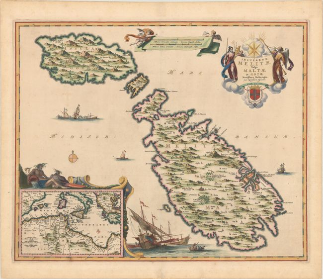
This splendid map shows the strategic island of Malta along with the smaller islands of Ghawdex (Gozo) and Kemmuna (Comino) to its northwest. The fortified city of Valetta is prominently shown along the eastern coast, as is Mdina near the middle of the island. An inset at bottom left shows the entire Mediterranean Sea along with portions of southern Europe and northern Africa. The map is highly decorative with a large sailing ship at bottom, a naval war scene, and Poseidon resting above the inset map. The title cartouche is decorated by the coat of arms of the Order of Malta, and a banner containing two distance scales is held aloft by two putti. Blank verso.
References:
Condition: B+
Full original color with lovely gilt highlights. There is minor scattered foxing in the image and minor tape stains in the top blank margin away from the image caused by cello tape on verso that has since been removed. Very nearly an "A" example.