Catalog Archive
Auction 166, Lot 573

"Tabula Italiae Antiquae in Regiones XI ab Augusto Divisae et tum ad Mensuras Itinerarias tum ad Observationes Astronomicas Exactae", Senex, John
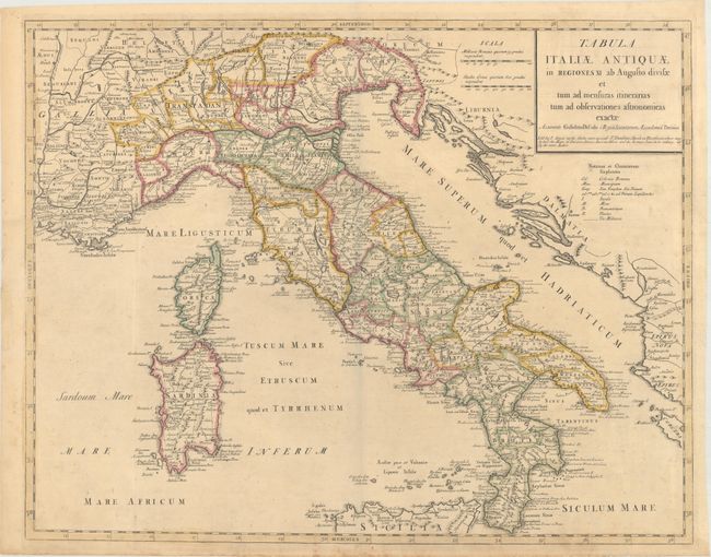
Subject: Italy

Period: 1715 (circa)

Publication:

Color: Hand Color

Size:
24.1 x 19.1 inches
61.2 x 48.5 cm
Download High Resolution Image
(or just click on image to launch the Zoom viewer)

A very fine, large, historical map of Italy with the islands of Corsica, Sardinia, and the tip of Sicily. The Roman Provinces, as described by Pliny, are delineated. The map is filled with Roman place names and notations of early roads. This is an English version of Guillaume Delisle's map of the same title. John Senex one of the leading English cartographers of the 18th century, published a number of maps based on Delisle’s cartography.

References:

Condition: A

Original outline color with marginal soiling. There are a few short tears in blank margins, one of which enters just enters map border at right, that have been closed on verso with archival materials.

Estimate: $350 - $425

Unsold

Closed on 2/14/2018

Archived