Subject: Czech Republic
Period: 1761 (dated)
Publication: Nouvel Atlas Portatif
Color: Hand Color
Size:
9 x 9.4 inches
22.9 x 23.9 cm
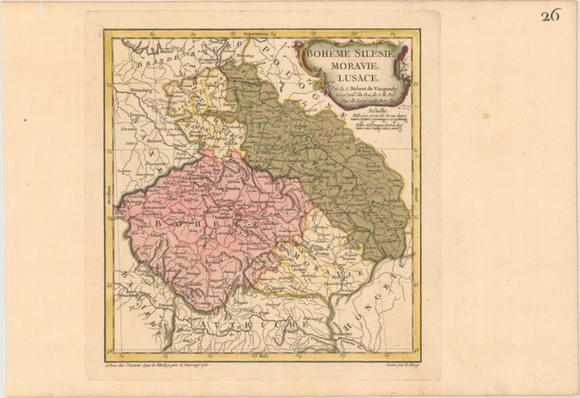
The first state of this delicately engraved map that covers the heart of Europe, the former duchies of Bohemia, Silesia, Moravia and Lusatia. Based on the cartography of Johann Muller, the map is focused roughly on Konigsgratz (Konigingretz), and extends to include the southwestern part of Poland and the eastern part of Germany. The map is filled with detail of towns, river systems and topography. The map was engraved by E. Dussy and the cartouche by Arrivet.
References: Pedley #286.
Condition: A
A crisp impression with original color in the map and later color in the cartouche on paper with a Strasbourg Lily watermark. There are several worm holes confined to the far blank margins.