Subject: Northeastern Germany & Northwestern Poland
Period: 1635 (published)
Publication: Historia Mundi or Mercators Atlas...
Color: Hand Color
Size:
7.1 x 4.9 inches
18 x 12.4 cm
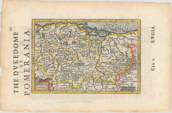
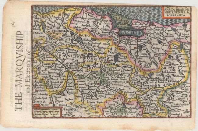
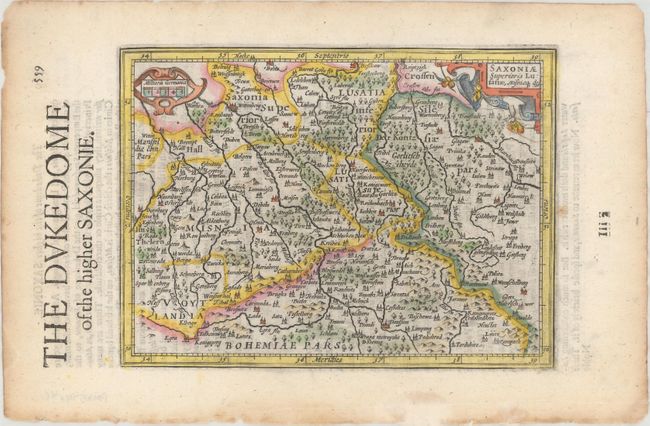
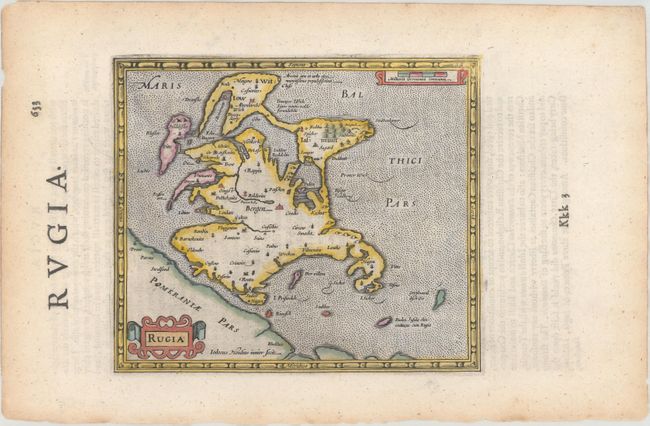
This matching set of maps comes from the English edition of Mercator's Atlas Minor, which was published under the title Historia Mundi or Mercators Atlas by Michael Spark and Samuel Cartwright. After acquiring the plates to the 1607 edition of the Mercator/Hondius Atlas Minor, Sparke republished the maps with text translated into English by Wye Saltonstall. Sparke also had 41 additional maps engraved for the Historia Mundi. Most of these maps were copied from Cloppenburg's edition of Atlas Minor and are therefore a bit larger, with some signed by the engravers Jacob van Langren and Ralph Hall. These additional maps only appeared in the 1635, 1637 and 1639 editions of the Historia Mundi and are therefore quite scarce. Included in this lot are four maps of northeastern Germany and northwestern Poland, including one of the newly engraved maps. Each map is adorned with a decorative title cartouche and a distance scale. English text on verso. Sizes vary slightly.
A. Brandeburg et Pomerania. Shows the coastline from Wismar, Germany to Koszalin, Poland.
B. Marca Brandenburgensis & Pomerania. Again shows the coastline from Wismar, Germany to Koszalin, Poland with more detail.
C. Saxoniae Superioris Lusatiae, Misniaeq Des. Extends from Wittenberge in the northwest to the Oder River in the east, and as far south as Prague.
D. Rugia. The island of Rugen.
References: Van der Krogt (Vol. III) #2100:351, #2170:351, #2170:351 (Sparke), #2192:351.
Condition: A
Nice impressions with light toning along the edges of the sheets and some small chips and tears also along the edges. The map of Marca Brandenburgensis has some loss of the border at top right due to the plate not being centered properly on the sheet during the printing process.