Subject: Western France
Period: 1579 (dated)
Publication: Theatrum Orbis Terrarum
Color: Hand Color
Size:
18.6 x 13.9 inches
47.2 x 35.3 cm
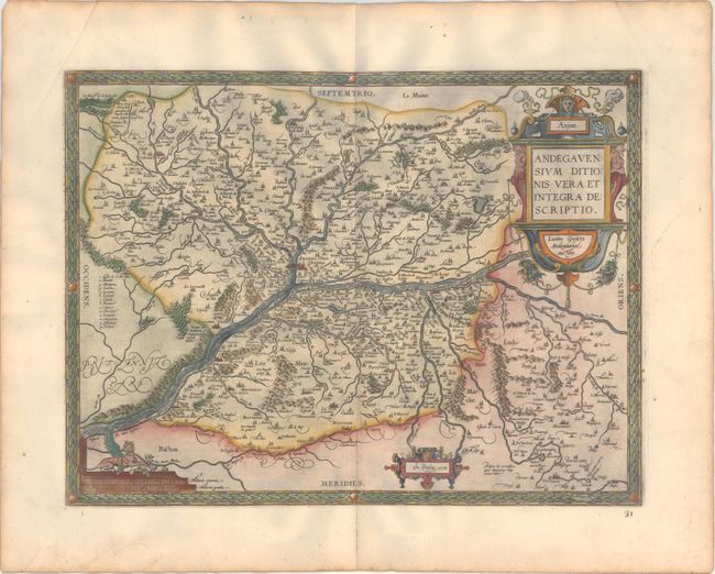
This is an attractive regional map of France focused on the Anjou region of western France, the present day department of Maine-et-Loire. Angers is at map center and is located next to the Maine and Loire rivers. There are numerous bridges displayed and there is a key at left identifying various islands in the Loire River. Ortelius based the map on a now lost map by Lezin Guyet that was published in Paris, 1573. It is richly embellished with bold cartouches and a harpy atop the distance scale. French text on verso, published in 1598.
References: Van den Broecke #40.
Condition: A
A dark impression on paper with the common horn coat of arms watermark found on Ortelius maps. There is light printer's ink residue, a crease at top left, and some toning along the edges of the sheet. Old manuscript page number below the map at right.