Subject: England & Wales
Period: 1598 (published)
Publication: Theatrum Orbis Terrarum
Color: Hand Color
Size:
18.4 x 14.9 inches
46.7 x 37.8 cm
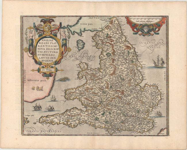
Stunning map of England and Wales compiled from Mercator's 1564 wall map of the British Isles and Lhuyd's manuscript map of 1568. The countryside is fully engraved with topographical features and hundreds of towns. This map improved on Mercator's outline of the countries particularly in Cardigan and South Wales, the Devon peninsula, and the Wash and Humber inlets. Interestingly the Caernarvon peninsula, near Lhuyd's hometown of Denbigh, is badly distorted and it has been suggested that this may be due to his sketching it from one of the nearby mountains. Sea monsters and five sailing ships occupy the stipple engraved oceans. A flock of sheep is shown in Ireland and there are two large, elaborate cartouches. This is the third state, with French text on verso.
References: Shirley (BI to 1650) #211; Van den Broecke #19.3.
Condition: A
A superb impression on paper with the common horn coat of arms watermark found on Ortelius maps. There is minor toning along the centerfold at bottom and along the edges of the sheet. Old manuscript page number below the map at right.