Subject: South Pole
Period: 1714 (published)
Publication: Atlas Geographique et Universel
Color: Hand Color
Size:
18.3 x 18 inches
46.5 x 45.7 cm
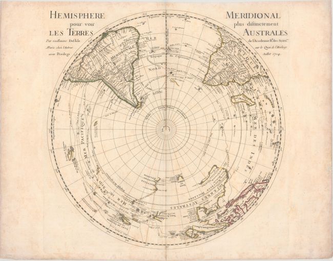
Delisle's map depicting the Southern Hemisphere shows the tracks of the explorers and circumnavigators around the southern oceans including Magellan in 1520, Abel Tasman in 1642, and Edmund Halley in 1698-1700. The map provides very good detail, particularly of the explorations and discoveries in the South Pacific. Australia, New Guinea, Tasmania, and New Zealand are partially delineated, with Australia and New Guinea nearly attached to one another.
References: Tooley (Australia) p. xxxi, #42.
Condition: B+
Original outline color with a watermark of the Christogram IHS. There is light offsetting, minor toning that is more pronounced along the sheet edges, and light scattered foxing. A short centerfold separation in the bottom blank margin has been archivally repaired.