Subject: Britain
Period: 1753 (published)
Publication:
Color: Black & White
Size:
9.7 x 15.8 inches
24.6 x 40.1 cm
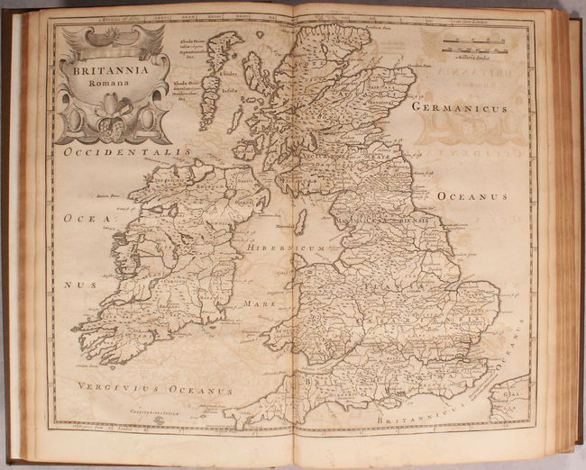
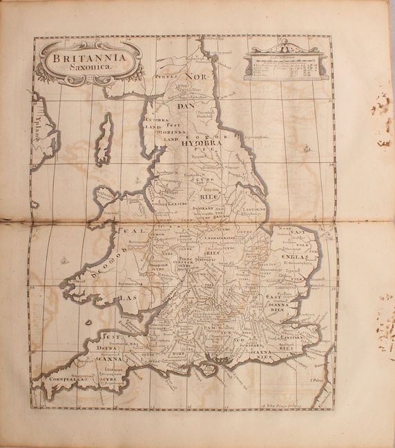
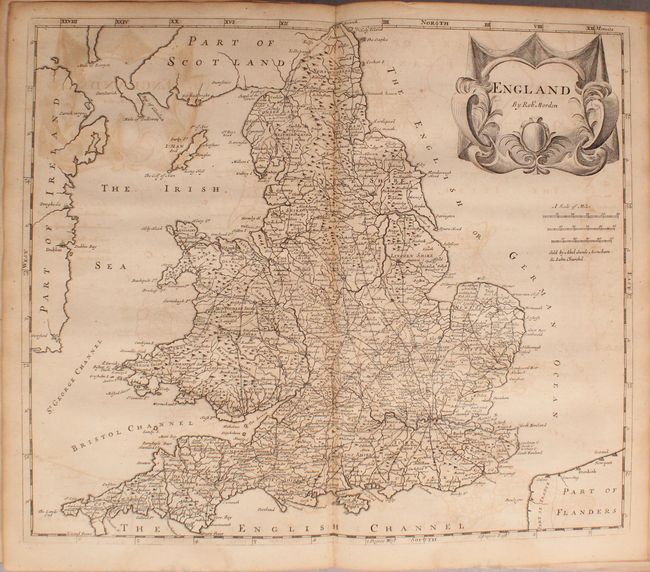
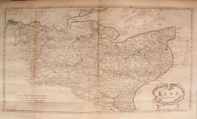
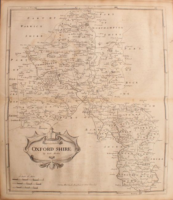
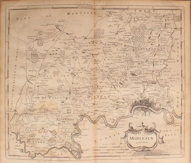
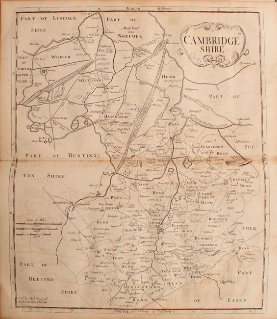
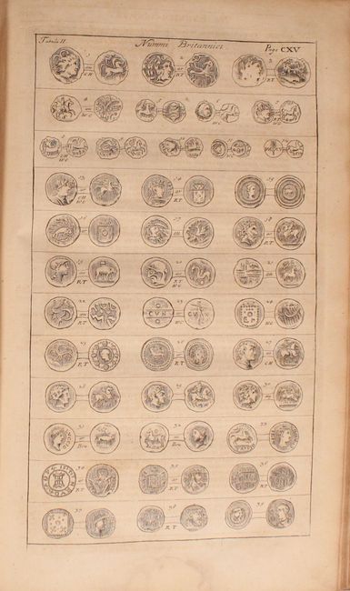
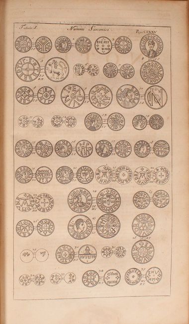
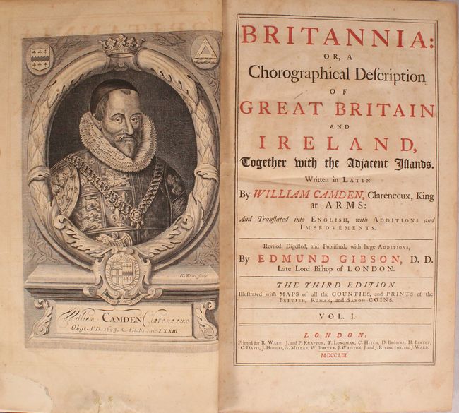
This is the third edition of Edmund Gibson's English translation of William Camden's Britannia. It is complete with 51 maps engraved by Robert Morden, mostly of counties, along with maps of ancient Britain, England, Scotland and Ireland. It includes desirable maps of Middlesex, Kent, Cambridge and Oxford along with seven plates depicting various Saxon coins. The majority of the maps are based on Christopher Saxton's monumental survey of England and Wales, as no additional surveying had been completed at the time of publication. Each is finely engraved with handsome embellishments including elaborate title cartouches and decorative distance scales. The full list of double-page maps include:
Britannia Romana
Britannia Saxonica. Condition: Worming confined to the bottom blank margin.
England
Cornwall
Devonshire
Dorsetshire
Somersetshire
Wiltshire
Hampshire
Barkshire
Surrey
Sussex
Kent (folding, 24.7 x 13.7"). Condition: There is a small split at a fold intersection and light dampstains at bottom.
Gloucestershire
Oxfordshire
Buckinghamshire
Bedfordshire
Hertfordshire
Middlesex
Essex
Suffolk
Norfolk
Cambridgeshire
Huntingtonshire
Northamptonshire
Leicestershire
Comitatus Rotelandiae Tabula Nova & Aucta
Lincolnshire
Nottinghamshire
Darbyshire
Warwickshire
Worcestershire
Staffordshire
Shropshire
The County Palatine of Chester
Herefordshire
A New and Correct Map of North-Wales
South Wales
The County of Monmouth
The West Riding of Yorkshire
The East Riding of Yorkshire
The North Riding of Yorkshire
The Bishoprick of Durham
The County Palatine of Lancaster
Westmorland
Cumberland
Northumberland
A New Map of the South Part of Scotland
A New Map of the North Part of Scotland
The Kingdom of Ireland
The Smaller Islands in the British Ocean
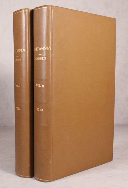
2 volumes with frontispiece of William Camden (volume 1), title pages, 48 page introduction, 1526 pages of text, appendix, and index. Folio, hardbound in modern brown cloth with gilt titles on spines.
References: Shirley (BL Atlases) T.CAMD-5d.
Condition: B
The maps are good to very good with overall light toning and light to moderate offsetting (see description for additional details). The text has moderate toning, scattered foxing, and occasional dampstains mostly in the bottom blank margin (volume 1 only). There is a small chip in the lower left blank margin of the frontispiece that has been backed with old paper. The text block of volume one is starting to separate at top, but still intact. Modern covers have light shelf wear.