Subject: Britain
Period: 1711 (published)
Publication: Introductio in Universam Geographiam
Color: Hand Color
Size:
9.9 x 8.3 inches
25.1 x 21.1 cm
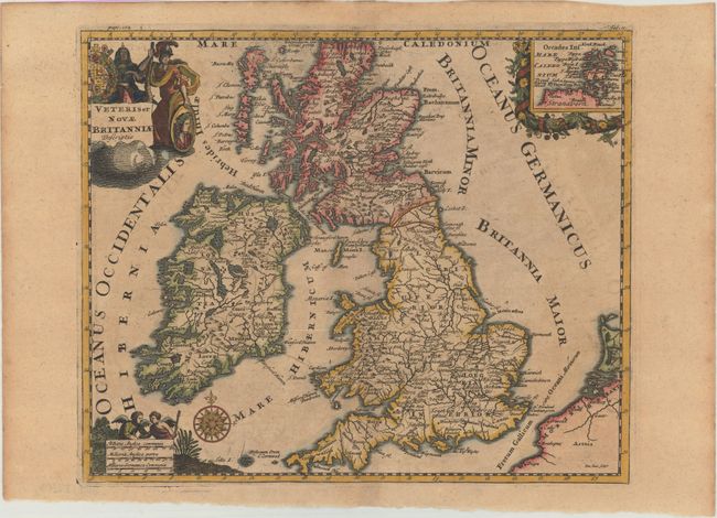
Very decorative small map of Britain showing counties and major cities. A decorative inset at upper right depicts the Orkney Islands. Embellished with a compass rose, distance scale with two angels, and a title cartouche featuring the royal coat of arms and a soldier. John Senex's imprint appears at bottom right.
Cluver's Introductio in Universam Geographicam was a popular atlas, appearing in over 45 editions during a 100-year period. The first edition was published without maps in the 1620s, and the first edition to include maps was published circa 1641. The various editions were published in different cities throughout Europe, including Amsterdam, Nuremberg, and London. This map is from a London edition, with the majority of the maps re-engraved by John Senex.
References: Shirley (BL Atlases) T.CLUV-9a #9.
Condition: B+
Light toning with a hint of offsetting and two tiny worm holes only visible when held to light.