Subject: Britain
Period: 1680 (circa)
Publication: Atlas Novus
Color: Hand Color
Size:
21.5 x 17 inches
54.6 x 43.2 cm
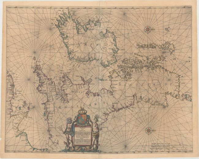
Rare and elegantly engraved chart of the British Isles and English Channel, based on a chart by Anthony Jacobsz from 1644. Place names are confined to the coastlines, and soundings, rocks, shoals, and other navigational information are included. Two decorative compass roses orient north to the right. The title cartouche is flanked by two ancient Britons, who stand upon sea monsters and hold the royal coat of arms. Latin text on verso.
References: Shirley (BI to 1650) #659; Shirley (BI to 1750) Jansson 1; Van der Krogt (Vol. I) #0130:1.
Condition: B
There is light printer's ink residue, minor soiling, and numerous small abrasions along the centerfold. A centerfold separation at bottom has been closed on verso with old paper.